Area Overview for LS7 1EF
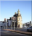
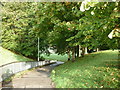
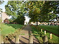
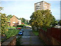
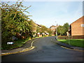
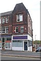
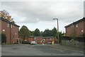
Photos of LS7 1EF


Area Information
LS7 1EF is a small, tightly knit residential postcode in England, home to 2,293 people. This area is characterised by its compact size and proximity to Leeds, offering a blend of urban convenience and residential tranquillity. The community is predominantly made up of adults aged 30–64, with a median age of 22, suggesting a mix of younger and older residents. Daily life here is shaped by the area’s practical layout, with easy access to nearby amenities such as retail outlets, rail stations, and essential services. The postcode’s small footprint means residents are likely to know their neighbours, fostering a close-knit environment. While the area lacks large-scale attractions, its strategic location near Leeds provides opportunities for work, leisure, and education. Living in LS7 1EF suits those who prioritise accessibility over sprawling landscapes, with a focus on functional living. The presence of flats as the primary accommodation type reflects a rental-oriented market, which may appeal to those seeking flexibility in housing. For buyers, the area’s limited size means properties are few, but those available are likely to be in proximity to key transport links and local services.
- Area Type
- Postcode
- Area Size
- Not available
- Population
- 2293
- Population Density
- 10538 people/km²
The property market in LS7 1EF is characterised by a low home ownership rate of 10%, indicating that the majority of residents rent their homes. Flats are the predominant accommodation type, which suggests a housing stock focused on smaller, often multi-unit developments. This dynamic points to a rental market rather than an owner-occupied one, making LS7 1EF an area where buyers may find limited opportunities for purchasing property. The small size of the postcode means the immediate surroundings are likely to have similar housing patterns, with few detached or semi-detached homes available. For those considering buying in the area, the scarcity of owner-occupied properties may limit options, though the proximity to transport links and amenities could offset this. The flat-based market may appeal to those seeking manageable, low-maintenance housing, but buyers should be prepared for a competitive rental environment.
House Prices in LS7 1EF
No properties found in this postcode.
Energy Efficiency in LS7 1EF
Living in LS7 1EF offers access to a range of nearby amenities, including retail outlets and rail stations. The area’s retail options include Aldi Harehills, Spar Roseville, and Heron Burnmantofts, providing essential shopping and convenience services within practical reach. These stores cater to daily needs, from groceries to household items, reducing the necessity for long journeys. The proximity to rail stations such as Leeds, Burley Park, and Headingley enhances mobility, connecting residents to the broader region for work, leisure, or socialising. While the data does not mention parks or leisure facilities, the availability of retail and transport options suggests a lifestyle focused on practicality and accessibility. The character of the area is defined by its functional approach to living, with amenities designed to meet the needs of a compact, urbanised community.
Amenities
Schools
The nearest school to LS7 1EF is Woodside School, a special school catering to students with specific educational needs. While no other schools are listed in the data, the presence of a special school suggests the area may have a focus on supporting families with children requiring tailored education. For families seeking mainstream schooling, the absence of other schools in the immediate vicinity means residents may need to look further afield. The type of school available reflects the community’s needs, though it does not provide a full range of educational options. Parents considering LS7 1EF should factor in the need for additional travel to access other schools, particularly for younger children or those requiring a broader curriculum.
| Rank | School | Type | Entry gender | Ages |
|---|
Explore more schools in this area
Go to Schools tabDemographics
The population of LS7 1EF is 2,293, with adults aged 30–64 forming the largest age group. The median age of 22 indicates a younger demographic, though this may reflect the presence of students or younger professionals. Home ownership is low, with only 10% of residents owning their homes, suggesting a rental market dominates. Flats are the primary accommodation type, reflecting a focus on smaller, managed housing units. The predominant ethnic group is Black, which shapes the area’s cultural landscape. While specific data on deprivation is not provided, the low home ownership rate and flat-based housing may indicate a community with a higher proportion of renters, potentially influencing local economic dynamics. The age profile suggests a mix of established residents and those in transitional life stages, such as students or young professionals. This demographic profile may affect local services, with a focus on affordable housing and community-oriented amenities.
Household Size
Accommodation Type
Tenure
Ethnic Group
Religion
Household Composition
Age
Household Deprivation
NS-SEC
Explore more demographic insights in this area
Go to Demographics tabPlanning
Planning Constraints
- Flood RiskPremium
- Ramsar Wetland SitesPremium
- Area of Outstanding Natural BeautyPremium
- Protected Nature ReservePremium
- Protected WoodlandPremium