Area Overview for LS3 1JN
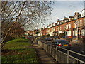
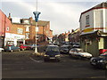
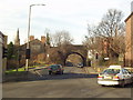
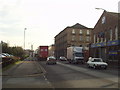
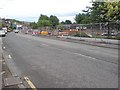
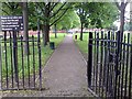
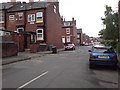
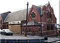
Photos of LS3 1JN
Area Information
LS3 1JN is a small, densely populated residential area in England, covering 2854 square metres and home to 1961 residents. With a population density of 1815 people per square kilometre, this postcode area is compact, reflecting its role as a tightly knit residential cluster. The community is predominantly composed of adults aged 30-64, with a median age of 47, suggesting a stable, mature population. Daily life here is shaped by proximity to essential services and transport links, though the area’s small size means it is best suited for those prioritising convenience over expansive living space. Residents benefit from nearby retail options, railway stations, and proximity to Leeds Bradford Airport, making it accessible for commuters and travellers. However, the area’s high population density and limited housing stock—only 26% of homes are owner-occupied—indicate a rental-dominated market. While the community is cohesive, its challenges, such as safety concerns, require careful consideration for prospective buyers.
- Area Type
- Postcode
- Area Size
- 2854 m²
- Population
- 1961
- Population Density
- 1815 people/km²
The property market in LS3 1JN is characterised by a low home ownership rate, with only 26% of properties owned by residents. This suggests the area is primarily a rental market, which may appeal to those seeking short-term or flexible housing solutions. The accommodation type is predominantly houses, though the small area size and high density imply these are likely smaller, multi-family homes or terraced properties. Given the limited housing stock, the market is unlikely to offer a wide range of options, and buyers may find competition for available properties. The area’s compact nature means it is best suited for those prioritising proximity to amenities over spacious living environments. For investors, the rental demand could be strong, but the high population density and safety concerns may deter some buyers. Prospective purchasers should consider the area’s constraints when evaluating its potential as a long-term investment.
House Prices in LS3 1JN
No properties found in this postcode.
Energy Efficiency in LS3 1JN
Living in LS3 1JN offers access to a range of amenities within practical reach. The area is close to major retail outlets such as Tesco Leeds, Asda Armley, and Morrisons Daily Leeds, ensuring residents have convenient access to groceries and everyday shopping. For transport, nearby railway stations like Burley Park, Leeds, and Headingley provide connections to key destinations, while proximity to Leeds Bradford Airport facilitates travel. Though the data does not mention parks or leisure facilities, the area’s compact nature suggests a focus on urban convenience rather than expansive green spaces. The mix of retail, rail, and airport access creates a lifestyle that prioritises ease of movement and accessibility. However, the absence of detailed information on leisure options means prospective buyers should investigate further for recreational opportunities.
Amenities
Schools
The nearest schools to LS3 1JN include Castleton Primary School, a primary school with an Ofsted rating of 'good'. This school serves the local community, providing education for younger children. While the data lists Castleton Primary School twice, it appears to be the only primary school in the immediate vicinity. The absence of secondary schools or other educational institutions in the data suggests that families may need to travel beyond LS3 1JN for comprehensive schooling. The presence of a 'good' rated primary school is a positive factor for parents prioritising quality early education, though the lack of additional school types may limit options for older children. Families considering LS3 1JN should assess the proximity of secondary schools and other educational facilities in surrounding areas.
| Rank | School | Type | Entry gender | Ages |
|---|
Explore more schools in this area
Go to Schools tabDemographics
The demographic profile of LS3 1JN is defined by its mature population, with a median age of 47 and the majority of residents falling within the 30-64 age range. This suggests a community of established professionals and families, rather than a younger, transient population. Only 26% of homes are owner-occupied, indicating a high proportion of renters, which may reflect the area’s limited housing stock or affordability pressures. The predominant accommodation type is houses, though the small area size and high density suggest these are likely terraced or semi-detached properties. The predominant ethnic group is White, with no data provided on other demographics. The population density of 1815 people per square kilometre highlights the area’s compact nature, which can influence the pace of life and access to shared resources. For residents, this density may mean a strong sense of community but also potential strain on local infrastructure and services.
Household Size
Accommodation Type
Tenure
Ethnic Group
Religion
Household Composition
Age
Household Deprivation
NS-SEC
Explore more demographic insights in this area
Go to Demographics tabPlanning
Planning Constraints
- Flood RiskPremium
- Ramsar Wetland SitesPremium
- Area of Outstanding Natural BeautyPremium
- Protected Nature ReservePremium
- Protected WoodlandPremium