Area Overview for LS1 1TW
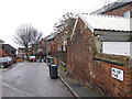
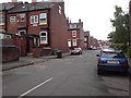
Photos of LS1 1TW


Area Information
LS1 1TW is a small, tightly knit residential postcode area in England, home to 1,693 people. It is a compact cluster of properties, predominantly flats, catering to a young and dynamic population. With a median age of 22, the area is dominated by young adults aged 15–29, reflecting a community centred around education, early careers, and urban living. The postcode’s proximity to key amenities and transport links makes it a practical choice for those prioritising convenience over space. Residents benefit from excellent broadband connectivity and access to multiple rail stations, including Burley Park and Leeds Railway Station, which link to broader regional networks. While the area lacks natural landscapes or protected sites, its strategic location near retail hubs like Tesco Leeds and Asda Armley ensures daily needs are met within easy reach. Living in LS1 1TW means navigating a youthful, fast-paced environment with a focus on accessibility and modern infrastructure, though the high crime risk necessitates vigilance.
- Area Type
- Postcode
- Area Size
- Not available
- Population
- 1693
- Population Density
- 6038 people/km²
The property market in LS1 1TW is characterised by low home ownership, with only 12% of residents owning their homes. This suggests the area functions more as a rental market than an owner-occupied one, likely serving students, temporary workers, or those in early careers. The accommodation type is predominantly flats, which aligns with the needs of a young, mobile population seeking affordable, compact living. Given the small size of the postcode, the housing stock is limited, and buyers should consider the surrounding areas for more options. The lack of data on property prices or availability means the market’s competitiveness is unclear, but the high proportion of rentals indicates a focus on short-term tenancies. For those seeking long-term investment, the area’s youth-driven profile may present challenges in terms of stability and appreciation.
House Prices in LS1 1TW
No properties found in this postcode.
Energy Efficiency in LS1 1TW
Residents of LS1 1TW enjoy a range of amenities within practical reach. Retail options include major supermarkets like Tesco Leeds, Morrisons Daily Leeds, and Asda Armley, ensuring daily shopping needs are met. The area’s proximity to rail stations and airports enhances mobility, making it easy to access urban hubs or travel further afield. While the postcode itself is small, the surrounding area offers a mix of convenience and connectivity. The lack of natural parks or leisure facilities within LS1 1TW means outdoor activities may require travel, but the presence of retail and transport infrastructure compensates with practicality. The lifestyle here is defined by accessibility—shopping, commuting, and travel are all within short distances, catering to a community that values efficiency over expansive recreational spaces.
Amenities
Schools
Residents of LS1 1TW have access to two primary schools: Rosebank Primary School, which holds a ‘good’ Ofsted rating, and Westfield First School. Both institutions cater to younger children, offering foundational education in the area. The absence of secondary schools nearby means families may need to consider commuting to adjacent postcodes for secondary education. The presence of two primary schools provides some choice for parents, though the quality of education is limited to primary levels. This dynamic is typical of smaller residential clusters, where infrastructure is focused on essential services rather than comprehensive schooling. For families prioritising proximity to schools, the availability of primary education within the area is a practical advantage, but long-term educational planning may require looking beyond LS1 1TW.
| Rank | School | Type | Entry gender | Ages |
|---|
Explore more schools in this area
Go to Schools tabDemographics
The population of LS1 1TW is overwhelmingly young, with a median age of 22 and 12% of residents owning their homes. This suggests a rental-dominated market, typical of areas with transient populations. The majority of residents are aged 15–29, indicating a community shaped by students, graduates, and young professionals. Accommodation is predominantly flats, reflecting a preference for smaller, manageable living spaces. The predominant ethnic group is White, with no data provided on other demographics. The low home ownership rate (12%) implies limited long-term residency, which may affect community cohesion. While the area’s youthfulness brings energy, it also means services and amenities are tailored to younger demographics. The absence of specific deprivation data means quality of life factors like employment opportunities or social services remain unquantified but are likely influenced by the area’s proximity to urban centres.
Household Size
Accommodation Type
Tenure
Ethnic Group
Religion
Household Composition
Age
Household Deprivation
NS-SEC
Explore more demographic insights in this area
Go to Demographics tabPlanning
Planning Constraints
- Flood RiskPremium
- Ramsar Wetland SitesPremium
- Area of Outstanding Natural BeautyPremium
- Protected Nature ReservePremium
- Protected WoodlandPremium