Area Overview for LS29 8PQ
Photos of LS29 8PQ
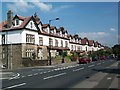
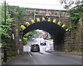
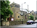
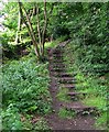
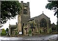
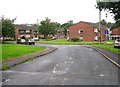
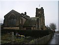
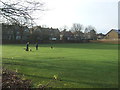

100 photos from this area
Area Information
Key information about the LS29 8PQ including its size, population, and administrative classification.
- Area Type
- Postcode
- Area Size
- 7023 m²
- Population
- 1611
- Population Density
- 1837 people/km²
House Prices in LS29 8PQ
19
Properties
£263,715
Average Sold Price
£68,000
Lowest Price
£480,300
Highest Price
Showing 19 properties
| Address | Type | Beds | Baths | Last Sale Price | Last Sale Date | |
|---|---|---|---|---|---|---|
| 3 Strathmore Road, Ilkley, LS29 8PQ | Detached | 2 | 2 | £480,300 | Feb 2025 | |
| 11 Strathmore Road, Ilkley, LS29 8PQ | Semi-detached | 4 | 2 | £465,000 | Jul 2023 | |
| 9 Strathmore Road, Ilkley, LS29 8PQ | house | - | - | £435,500 | Oct 2020 | |
| 15 Strathmore Road, Ilkley, LS29 8PQ | Semi-detached | - | - | £282,000 | Jun 2017 | |
| 14 Strathmore Road, Ilkley, LS29 8PQ | Semi-detached | 4 | - | £275,000 | Oct 2015 | |
| 6 Strathmore Road, Ilkley, LS29 8PQ | house | - | - | £295,000 | Aug 2014 | |
| 7 Strathmore Road, Ilkley, LS29 8PQ | house | 3 | - | £190,500 | Jul 2011 | |
| 12 Strathmore Road, Ilkley, LS29 8PQ | house | - | - | £215,000 | Dec 2009 | |
| 8 Strathmore Road, Ilkley, LS29 8PQ | Semi-detached | - | - | £335,000 | Jun 2008 | |
| 13 Strathmore Road, Ilkley, LS29 8PQ | Semi-detached | - | - | £186,000 | Apr 2004 |
Page 1 of 2
Energy Efficiency in LS29 8PQ
Amenities
Schools
| Rank | School | Type | Entry gender | Ages |
|---|
Explore more schools in this area
Go to Schools tabDemographics
Household Size
Family (3-5 people)
most common
Accommodation Type
Houses
most common
Tenure
89
majority
Ethnic Group
White
most common
Religion
N/A
most common
Household Composition
N/A
most common
Age
47
median
Adults (30-64 years)
most common
Household Deprivation
N/A
with no deprivation
NS-SEC
56
in Lower managerial occupations
Explore more demographic insights in this area
Go to Demographics tabPlanning
Planning Constraints
- Flood RiskPremium
- Ramsar Wetland SitesPremium
- Area of Outstanding Natural BeautyPremium
- Protected Nature ReservePremium
- Protected WoodlandPremium