Area Overview for LS29 8PF
Photos of LS29 8PF

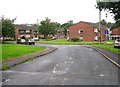
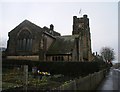
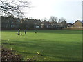


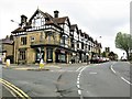
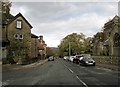
100 photos from this area
Area Information
Key information about the LS29 8PF including its size, population, and administrative classification.
- Area Type
- Postcode
- Area Size
- 1.2 hectares
- Population
- 1977
- Population Density
- 4760 people/km²
House Prices in LS29 8PF
74
Properties
£265,448
Average Sold Price
£60,000
Lowest Price
£435,000
Highest Price
Showing 74 properties
| Address | Type | Beds | Baths | Last Sale Price | Last Sale Date | |
|---|---|---|---|---|---|---|
| 21, Emmandjay Court, Valley Drive, Ilkley, LS29 8PF | Flat | 1 | 1 | £60,000 | Oct 2025 | |
| 56, Emmandjay Court, Valley Drive, Ilkley, LS29 8PF | Flat | 2 | 2 | £250,000 | May 2025 | |
| 22, Emmandjay Court, Valley Drive, Ilkley, LS29 8PF | Flat | 2 | - | £285,000 | Aug 2023 | |
| 15, Emmandjay Court, Valley Drive, Ilkley, LS29 8PF | Flat | 3 | 2 | £270,000 | Oct 2022 | |
| 50, Emmandjay Court, Valley Drive, Ilkley, LS29 8PF | Flat | 2 | 2 | £282,000 | Jul 2022 | |
| 14, Emmandjay Court, Valley Drive, Ilkley, LS29 8PF | Flat | 2 | 2 | £269,000 | Jun 2022 | |
| 24, Emmandjay Court, Valley Drive, Ilkley, LS29 8PF | Flat | - | - | £270,000 | Feb 2022 | |
| 25, Emmandjay Court, Valley Drive, Ilkley, LS29 8PF | Flat | 1 | 1 | £223,950 | Sep 2021 | |
| 119 Valley Drive, Ilkley, LS29 8PF | Semi-detached | 4 | - | £435,000 | Jun 2021 | |
| 17, Emmandjay Court, Valley Drive, Ilkley, LS29 8PF | Flat | 3 | - | £309,950 | Jun 2021 |
Page 1 of 8
Energy Efficiency in LS29 8PF
Amenities
Schools
| Rank | School | Type | Entry gender | Ages |
|---|
Explore more schools in this area
Go to Schools tabDemographics
Household Size
One person
most common
Accommodation Type
Houses
most common
Tenure
64
majority
Ethnic Group
White
most common
Religion
N/A
most common
Household Composition
N/A
most common
Age
47
median
Adults (30-64 years)
most common
Household Deprivation
N/A
with no deprivation
NS-SEC
34
in Lower managerial occupations
Explore more demographic insights in this area
Go to Demographics tabPlanning
Planning Constraints
- Flood RiskPremium
- Ramsar Wetland SitesPremium
- Area of Outstanding Natural BeautyPremium
- Protected Nature ReservePremium
- Protected WoodlandPremium