Area Overview for LS29 0JX
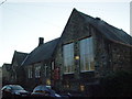
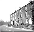
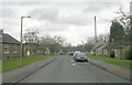
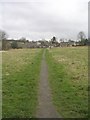
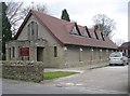
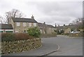
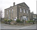
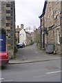
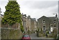
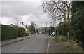
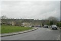
Photos of LS29 0JX

Area Information
Living in LS29 0JX offers a grounded experience within a specific residential cluster near Ilkley. This postcode covers an area of just 1,313 square metres, hosting a population of 1,057 residents. You are stepping into a tightly defined neighbourhood where daily life centres on the settlements of Addingham, Bolton Abbey, and nearby stations. The physical footprint is small, which often creates a sense of intimacy and reduced travel times compared to larger postcodes. You will find yourself surrounded by established housing rather than sprawling development projects. The location sits roughly between the historic Bolton Abbey and the commuter hub of Ilkley, balancing rural character with accessible transport links. Relying on proximity to key rail stations like Ilkley Railway Station and Ben Rhydding Station, you gain entry to wider employment markets in Leeds and Bradford without living in a busy urban centre. The area size suggests a complete community where neighbours know each other, supported by a resident population that mirrors the historical patterns of this border region. Daily routines involve easy access to local shops at Addingham and walks towards the Hambleton Hills. The compact nature of LS29 0JX means you can manage your week efficiently without excessive commuting. You trade the anonymity of a city for a defined locality where the distance to amenities like Co-op Addingham or Embsay station remains short. This setup suits those who prefer a static environment with clear boundaries around their home and immediate surroundings. The postcode represents a stable pocket of residential housing where the focus remains on existing community structures rather than new expansion.
- Area Type
- Postcode
- Area Size
- 1313 m²
- Population
- 1057
- Population Density
- 1182 people/km²
The property market in LS29 0JX presents a clear picture through the stark reality of accommodation types and ownership levels. With 70% of residents owning their properties, the area functions primarily as an owner-occupied zone rather than a rental market. This dynamic means that when you look at homes in LS29 0JX, you encounter established buyers focused on long-term residence rather than short-term tenants or students. The accommodation type is exclusively houses, which dictates the market structure and availability for purchasers. You will not find flats or apartment blocks within this postcode boundary, limiting the inventory to traditional detached, semi-detached, or terraced houses. This homogeneity suggests a property market driven by the needs of families and individuals seeking space rather than shared urban living. Given the small area size of 1,313 square metres, the number of specific properties is limited, meaning competition for suitable homes can be intense. Every available house in LS29 0JX represents a significant interest due to the high ownership percentage. For buyers, this environment offers stability but also a need for thorough research. The high rate of home ownership indicates that properties listed for sale are often the exceptions, not the rule. Those looking to move here must navigate a market where sellers hold onto their homes for decades. The lack of rental pressure contributes to price stability but may lengthen the time between viewings and completion. Anyone considering a move to this locality should prepare for a competitive landscape defined by自住 homes and limited supply.
House Prices in LS29 0JX
Showing 6 properties
| Address | Type | Beds | Baths | Last Sale Price | Last Sale Date | |
|---|---|---|---|---|---|---|
| 4, Chapel Fold, Brooks Court, School Lane, Addingham, LS29 0JX | Terraced | 2 | 1 | - | - | |
| 1, The Lodge, Brooks Court, School Lane, Addingham, LS29 0JX | Maisonette | 3 | 2 | - | - | |
| 2, Church Key Cottage, Brooks Court, School Lane, Addingham, LS29 0JX | Semi-detached | 4 | - | - | - | |
| 3, Moor View Cottage, Brooks Court, School Lane, Addingham, LS29 0JX | Semi-detached | 2 | - | - | - | |
| Former 1A, Brooks Court, School Lane, Addingham, LS29 0JX | Terraced | - | - | - | - | |
| 5, Daisy Hill Cottage, Brooks Court, School Lane, Addingham, LS29 0JX | Terraced | - | - | - | - |
Energy Efficiency in LS29 0JX
Daily life in LS29 0JX revolves around a select group of amenities that serve the immediate residential cluster. You have five retail options at your disposal, anchored by Co-op Addingham, Co-op Ilkley, and Co-op Silsden. These convenience stores allow you to handle grocery shopping and essential household needs without travelling deep into the city. For travel enthusiasts, two Metro attractions await you at Bolton Abbey and Embsay, offering easy weekend trips to the farm and market areas associated with these historic sites. Transport options are robust, with five rail stations connected to your postcode. Ilkley Railway Station, Ben Rhydding Station, and Steeton & Silsden Railway Station provide the backbone for commuting to Leeds and Bradford. These connections mean you do not need to rely solely on your private vehicle for regular travel. Shopping routines are centralised around the three Co-op branches, ensuring that daily essentials are within easy reach. The proximity to these specific venues creates a neighbourhood rhythm where routine tasks take place locally rather than abroad. Your lifestyle includes access to the Old Leeds and Ilkley route networks, blending proximity with the Calude Valley aesthetic. The five listed railway stations and two Metro sites offer a lifestyle that balances rural tranquility with urban connectivity. When you consider what living in LS29 0JX offers, you find a curated set of facilities designed for practical living. The presence of these specific amenities ensures that housewives, remote workers, and retirees all have access to necessary services within a short drive or walk.
Amenities
Schools
Education remains a priority for families considering a move to LS29 0JX, with Addingham Primary School forming the cornerstone of local provision. This primary institution holds an outstanding Ofsted rating, confirming its high standard of teaching and STAY classroom environment. Parents in the area apply to Addingham Primary School with confidence in the quality of education provided to young children. Just beyond the immediate catchment, Addingham Middle School serves as the educational bridge for students transitioning into secondary education options in the wider Ilkley region. The presence of an outstanding-rated primary school alongside a strong middle school suggests a cohesive local educational pathway for young learners. You do not need to commute far to secure a place in a well-regarded institution, as these schools are situated directly in Addingham. This proximity reduces travel time and fosters a stronger connection between students and their local learning community. Families living in this postcode benefit from a clear trajectory through the early years, with Addingham Primary School providing the initial point of contact for children. While data on specific secondary school Ofsted ratings within this immediate data set is limited, the presence of Addingham Middle School indicates local support for education beyond primary years. The concentration of schools in such a small area highlights the importance of education as a central pillar of community life in LS29 0JX. Parents can rely on these established institutions to deliver the curriculum required for their children's development.
| Rank | School | Type | Entry gender | Ages |
|---|
Explore more schools in this area
Go to Schools tabDemographics
You will join a community where age and home ownership define the social fabric of LS29 0JX. Evidence shows a high level of stability, with 70% of residents owning their homes outright or with a mortgage. This figure indicates a quarter-century or longer-term local presence for the majority of households. The demographic profile skews heavily towards maturity, with a median age of 47 years across the population. Most residents fall into the 30 to 64-year-old bracket, creating a workforce-age core without the large youth population found in cities. The housing stock consists entirely of houses, reflecting the preference of owners for brick-built single-family homes rather than flats or maisonettes. This exclusion of multi-unit developments aligns with the rural character of the region. Our data shows that while White residents form the predominant ethnic group, the area remains distinctly community-focused around family structures and long-term tenancy. With a population density that records 805,152 people per square kilometre based on the small 1,313 square metre footprint, the area feels settled and established rather than transient. There are no significant fluctuations in age groups to suggest a student influx or a retirement boom. Instead, you find a consistent demographic built around professional families and senior citizens who have put down roots in Ilkley's hinterlands. The housing ownership rate of 70% suggests high satisfaction with the current property stock. It also implies a market where buying locally requires access to significant capital or long-term lending. The absence of high-density accommodation types reinforces the quiet, suburban feel that characterises daily interactions in this postcode. Families here are likely to spend the majority of the year in the same homes they purchased.
Household Size
Accommodation Type
Tenure
Ethnic Group
Religion
Household Composition
Age
Household Deprivation
NS-SEC
Explore more demographic insights in this area
Go to Demographics tabPlanning
Planning Constraints
- Flood RiskPremium
- Ramsar Wetland SitesPremium
- Area of Outstanding Natural BeautyPremium
- Protected Nature ReservePremium
- Protected WoodlandPremium