Area Overview for LS28 7HG
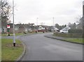
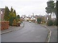
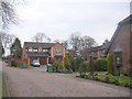
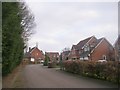
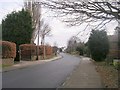
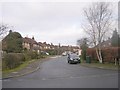
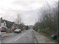
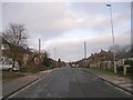
Photos of LS28 7HG
Area Information
LS28 7HG is a small, tightly knit postcode area in west Leeds, England, covering just 1.4 hectares and home to 2,169 residents. It sits within the Calverley and Farsley electoral ward, a historically significant region marked by medieval landmarks like Calverley Old Hall, a 14th-century manor house. The area is residential in character, with houses dominating the accommodation type and a strong sense of community. With a median age of 47 and a population skewed toward adults aged 30–64, the area reflects a mature demographic. Its proximity to the A657 road and nearby towns like Pudsey and Bradford makes it a practical location for commuters, while its compact size means amenities are within walking or short driving distance. The area’s history, including the 19th-century Calverley Cutting road, adds a layer of local interest. For buyers, LS28 7HG offers a blend of historical charm and modern convenience, with low crime rates and excellent broadband connectivity.
- Area Type
- Postcode
- Area Size
- 1.4 hectares
- Population
- 2169
- Population Density
- 1927 people/km²
LS28 7HG is a predominantly owner-occupied area, with 67% of homes owned by residents rather than rented. The accommodation type is exclusively houses, which is uncommon in many urban areas but typical for smaller, residential postcode clusters. This suggests a market focused on family homes rather than apartments or rental properties. The area’s compact size means the housing stock is limited, and buyers should consider nearby suburbs like Farsley or Pudsey for additional options. The high home ownership rate indicates a stable market with long-term residents, though the small size of the postcode means property availability is constrained. For buyers, this area is best suited for those seeking a single-family home in a low-crime, historically rich environment, with the added benefit of proximity to retail and transport links.
House Prices in LS28 7HG
Showing 23 properties
| Address | Type | Beds | Baths | Last Sale Price | Last Sale Date | |
|---|---|---|---|---|---|---|
| 32 Woodhall Park Crescent East, Stanningley, Pudsey, LS28 7HG | Detached | 4 | 2 | £495,000 | Sep 2025 | |
| 1 Woodhall Park Crescent East, Stanningley, Pudsey, LS28 7HG | Semi-detached | 4 | 3 | £520,200 | Jun 2025 | |
| 5 Woodhall Park Crescent East, Stanningley, Pudsey, LS28 7HG | house | - | - | £390,000 | Mar 2023 | |
| 11A Woodhall Park Crescent East, Stanningley, Pudsey, LS28 7HG | Detached | 2 | 3 | £385,000 | Mar 2022 | |
| 26 Woodhall Park Crescent East, Stanningley, Pudsey, LS28 7HG | Bungalow | 3 | - | £390,550 | Jan 2018 | |
| 15 Woodhall Park Crescent East, Stanningley, Pudsey, LS28 7HG | Bungalow | 3 | 2 | £252,500 | Dec 2015 | |
| 3 Woodhall Park Crescent East, Stanningley, Pudsey, LS28 7HG | Semi-detached | 5 | 2 | £300,000 | Jul 2015 | |
| 2 Woodhall Park Crescent East, Stanningley, Pudsey, LS28 7HG | house | - | - | £250,000 | May 2015 | |
| 10 Woodhall Park Crescent East, Stanningley, Pudsey, LS28 7HG | Detached | 4 | 1 | £310,000 | Sep 2013 | |
| 28 Woodhall Park Crescent East, Stanningley, Pudsey, LS28 7HG | Detached | 4 | 1 | £280,000 | Jul 2012 |
Energy Efficiency in LS28 7HG
Residents of LS28 7HG benefit from a range of amenities within practical reach. Retail options include major supermarkets like Morrisons and Asda, as well as M&S, all located in Pudsey, just a short drive away. The area’s rail connections, with five stations nearby, provide access to city centres and beyond, while the proximity to Leeds Bradford Airport adds to its connectivity. Though parks and leisure facilities are not explicitly listed in the data, the historical Calverley Cutting road and nearby villages suggest opportunities for walking or cycling. The presence of multiple schools and a low crime rate contributes to a family-friendly environment. For daily life, the combination of retail, transport, and historical sites creates a balanced lifestyle, blending practicality with local character.
Amenities
Schools
Residents of LS28 7HG have access to several primary schools, including Farsley Farfield Primary School and Farsley Farfield Junior School, both of which are rated ‘good’ by Ofsted. Priesthorpe School and Co-op Academy Priesthorpe provide additional primary education options, with the latter being an academy. The mix of traditional state schools and academies offers families a range of educational pathways. The presence of multiple primary schools within the area ensures convenience for parents, reducing the need for long commutes. While secondary schools are not listed in the data, the proximity to larger towns like Pudsey and Bradford likely provides access to comprehensive options. The quality of local education, combined with the area’s safety profile, makes LS28 7HG appealing to families prioritising school proximity and standards.
| Rank | School | Type | Entry gender | Ages |
|---|
Explore more schools in this area
Go to Schools tabDemographics
The population of LS28 7HG is predominantly adults aged 30–64, with a median age of 47. Home ownership is high at 67%, and the area is largely composed of houses rather than flats or apartments. The predominant ethnic group is Asian, though specific subgroups are not detailed. The ward as a whole has a population of 24,595, with 80.8% identifying as White and 13.8% as Asian. While deprivation data for the postcode itself is not specified, the broader ward ranks near the bottom of Leeds for deprivation, suggesting some residents may face economic challenges. This context is important for understanding the area’s social dynamics and the potential for community support networks. The demographic profile indicates a stable, established community with a focus on family-oriented living, reflected in the presence of multiple primary schools.
Household Size
Accommodation Type
Tenure
Ethnic Group
Religion
Household Composition
Age
Household Deprivation
NS-SEC
Explore more demographic insights in this area
Go to Demographics tabPlanning
Planning Constraints
- Flood RiskPremium
- Ramsar Wetland SitesPremium
- Area of Outstanding Natural BeautyPremium
- Protected Nature ReservePremium
- Protected WoodlandPremium