Area Overview for LS28 7HD
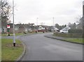
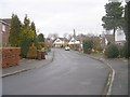
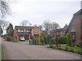
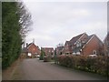
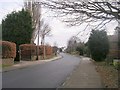
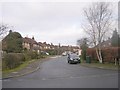
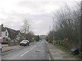
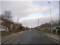
Photos of LS28 7HD
Area Information
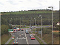
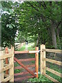
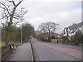
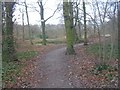
LS28 7HD is a compact residential postcode in west Leeds, nestled within the Calverley and Farsley ward. Covering 3,396 square metres, it is home to 2,169 residents, making it a densely populated area with 1,927 people per square kilometre. The postcode lies on the A657 road, approximately ten miles from Leeds city centre and four miles from Bradford, placing it at the crossroads of rural and suburban living. The area is steeped in history, including Calverley Old Hall, a 14th-century manor house, and Calverley Cutting, a 19th-century road carved through sandstone. Daily life here is shaped by its proximity to both urban and natural landscapes, with a mix of local amenities and commuter routes. The community is predominantly middle-aged, with a median age of 47, and reflects a blend of cultural backgrounds, though Asian residents make up the largest ethnic group. This small postcode offers a snapshot of a ward with a rich heritage, practical connectivity, and a tight-knit residential character.
- Area Type
- Postcode
- Area Size
- 3396 m²
- Population
- 2169
- Population Density
- 1927 people/km²
The property market in LS28 7HD is characterised by a high rate of home ownership, with 67% of residents living in owner-occupied houses. This suggests a community of long-term residents rather than a rental-heavy market. The predominance of houses over flats or apartments indicates a focus on family-sized homes, which may appeal to buyers seeking space and privacy. Given the area’s small size and high population density, property availability is likely limited, making it a competitive market for buyers. The compact nature of LS28 7HD means that properties here are part of a broader network of residential clusters in the Calverley and Farsley ward, offering buyers proximity to local amenities while maintaining a sense of seclusion from larger urban centres.
House Prices in LS28 7HD
Showing 6 properties
| Address | Type | Beds | Baths | Last Sale Price | Last Sale Date | |
|---|---|---|---|---|---|---|
| 6 Shortway, Stanningley, Pudsey, LS28 7HD | Detached | 7 | 3 | £450,000 | Jan 2021 | |
| 3 Shortway, Stanningley, Pudsey, LS28 7HD | Semi-detached | 4 | 3 | £368,000 | Mar 2020 | |
| 2 Shortway, Stanningley, Pudsey, LS28 7HD | Semi-detached | 4 | 1 | £270,000 | Jan 2020 | |
| 5 Shortway, Stanningley, Pudsey, LS28 7HD | Detached | 3 | - | £277,000 | Jan 2016 | |
| 1 Shortway, Stanningley, Pudsey, LS28 7HD | Semi-detached | - | - | £293,000 | Nov 2006 | |
| 4 Shortway, Stanningley, Pudsey, LS28 7HD | Semi-detached | - | - | £249,500 | Mar 2006 |
Energy Efficiency in LS28 7HD
Residents of LS28 7HD have access to a modest but functional range of amenities within practical reach. Retail options include Morrisons Daily Pudsey 489, Iceland Woodhall, and Asda Pudsey, providing essential shopping and grocery needs. The area is served by five railway stations, including New Pudsey Station, which enhances connectivity to nearby towns and cities. Proximity to Leeds Bradford Airport and Leeds Bradford International Airport adds convenience for travel. While the data does not specify parks or leisure facilities, the area’s historical features, such as Calverley Old Hall, suggest a blend of cultural and natural attractions. The combination of retail, rail, and air travel supports a lifestyle that balances local convenience with regional accessibility, though the absence of detailed information on leisure options means that further exploration may be required for a full picture of the area’s character.
Amenities
Schools
Residents of LS28 7HD have access to a range of primary schools, including Farsley Farfield Primary School and Farsley Farfield Junior School, both of which are rated ‘good’ by Ofsted. Priesthorpe School, another primary school in the area, serves the local community without an official Ofsted rating listed. Additionally, Co-op Academy Priesthorpe, an academy school, also holds a ‘good’ Ofsted rating. This mix of primary and academy schools provides families with options for early education, with a focus on maintaining quality standards. The presence of multiple schools within close proximity suggests that the area is well-served for families with children, though the absence of secondary schools means parents may need to look beyond LS28 7HD for further education.
| Rank | School | Type | Entry gender | Ages |
|---|
Explore more schools in this area
Go to Schools tabDemographics
The population of LS28 7HD has a median age of 47, with the majority of residents falling within the 30-64 age range. Home ownership is strong, with 67% of households owning their properties, and the accommodation type is predominantly houses, reflecting a more settled, family-oriented community. The predominant ethnic group is Asian_total, though the ward as a whole has a broader demographic composition, including 80.8% White residents. While specific deprivation data for LS28 7HD is not provided, the broader Calverley and Farsley ward has 81.9% of its population in the mid-range of deprivation, suggesting that quality of life here may be influenced by local economic factors. The age profile and ownership rates indicate a stable, long-term resident base, with fewer transient populations compared to more urban areas.
Household Size
Accommodation Type
Tenure
Ethnic Group
Religion
Household Composition
Age
Household Deprivation
NS-SEC
Explore more demographic insights in this area
Go to Demographics tabPlanning
Planning Constraints
- Flood RiskPremium
- Ramsar Wetland SitesPremium
- Area of Outstanding Natural BeautyPremium
- Protected Nature ReservePremium
- Protected WoodlandPremium