Area Overview for LS28 5UF
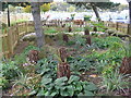
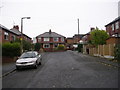
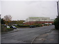
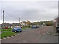
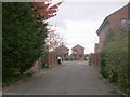
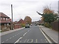
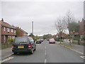
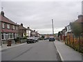
Photos of LS28 5UF
Area Information
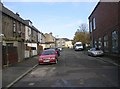
LS28 5UF is a small, densely populated residential postcode area in west Leeds, covering just 1.4 hectares and home to 1,581 people. Its compact size means it is part of the broader Calverley and Farsley ward, a historically significant area with medieval landmarks like Calverley Old Hall. The village lies on the A657 road, four miles from Bradford and ten miles from Leeds city centre, placing it in a semi-rural yet accessible location. Daily life here is shaped by its proximity to both urban and natural environments, though the area’s character is defined by its historical roots and modest scale. With a population density of 112,450 people per square kilometre, the community is tight-knit, and the area’s small footprint means amenities and services are closely clustered. Residents benefit from nearby transport links, including multiple railway stations and proximity to Leeds Bradford Airport, while the lack of major planning constraints allows for straightforward development. For those seeking a balance between historical charm and modern convenience, LS28 5UF offers a focused, manageable living environment.
- Area Type
- Postcode
- Area Size
- 1.4 hectares
- Population
- 1581
- Population Density
- 6844 people/km²
The property market in LS28 5UF is dominated by owner-occupied homes, with 73% of residents living in properties they own. The area’s accommodation type is primarily houses, reflecting a residential cluster that prioritises family homes over flats or apartments. This contrasts with larger urban areas where rental markets dominate, suggesting LS28 5UF is more suited to long-term homeownership. The small size of the postcode area means housing stock is limited, and buyers should consider proximity to nearby towns like Pudsey and Bradford for additional options. The high home ownership rate implies stable property values, though the area’s compact nature may restrict expansion. For those seeking a house in a semi-rural setting with easy access to transport, LS28 5UF offers a focused market, but buyers must weigh the benefits of ownership against the potential scarcity of new developments.
House Prices in LS28 5UF
Showing 18 properties
| Address | Type | Beds | Baths | Last Sale Price | Last Sale Date | |
|---|---|---|---|---|---|---|
| 3 New Park Walk, Farsley, Pudsey, LS28 5UF | Terraced | 2 | 1 | £217,500 | Oct 2024 | |
| 1 New Park Walk, Farsley, Pudsey, LS28 5UF | Terraced | 2 | 1 | £245,000 | Oct 2024 | |
| 19 New Park Walk, Farsley, Pudsey, LS28 5UF | Terraced | 2 | 1 | £235,000 | Apr 2024 | |
| 37 New Park Walk, Farsley, Pudsey, LS28 5UF | Retail | 1 | - | £110,000 | Feb 2023 | |
| 23 New Park Walk, Farsley, Pudsey, LS28 5UF | Flat | - | - | £79,000 | Aug 2022 | |
| 17 New Park Walk, Farsley, Pudsey, LS28 5UF | house | - | - | £155,000 | Aug 2017 | |
| 33 New Park Walk, Farsley, Pudsey, LS28 5UF | Flat | - | - | £85,000 | Aug 2017 | |
| 27 New Park Walk, Farsley, Pudsey, LS28 5UF | Flat | - | - | £79,000 | Jan 2017 | |
| 11 New Park Walk, Farsley, Pudsey, LS28 5UF | Terraced | 2 | 1 | £139,000 | Feb 2016 | |
| 21 New Park Walk, Farsley, Pudsey, LS28 5UF | Flat | - | - | £67,000 | Feb 2014 |
Energy Efficiency in LS28 5UF
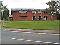
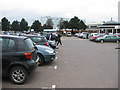
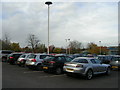
Living in LS28 5UF offers access to essential amenities within practical reach. Nearby retail options include Co-op Farsley, Lidl Bramley, and Asda Pudsey, providing grocery and everyday shopping needs. The area’s proximity to railway stations—New Pudsey, New Pudsey Station, and Bramley—facilitates easy travel to urban centres or nearby towns. While the postcode itself lacks detailed parks or leisure facilities, the broader Calverley and Farsley ward includes historical sites like Calverley Old Hall, a 14th-century manor house. Residents can also benefit from nearby airports, with Leeds Bradford Airport just a short drive away. The compact nature of LS28 5UF means amenities are closely clustered, reducing the need for long commutes. However, the absence of specific data on parks or dining options suggests a focus on functional, utilitarian living rather than extensive leisure infrastructure.
Amenities
Schools
The nearest school to LS28 5UF is Farsley Westroyd Primary School and Nursery, which provides education for younger children and holds a good Ofsted rating. This primary school is a key local institution, serving families in the immediate area. The absence of secondary schools within the postcode means students may need to travel to nearby towns like Pudsey or Bradford for higher education. The presence of a well-rated primary school is a significant draw for families, though parents should plan for secondary schooling options outside LS28 5UF. The school’s good rating indicates a commitment to quality education, which aligns with the area’s emphasis on stable, family-oriented living. For those prioritising proximity to schools, LS28 5UF’s primary education offering is a practical advantage.
| Rank | School | Type | Entry gender | Ages |
|---|
Explore more schools in this area
Go to Schools tabDemographics
The population of LS28 5UF has a median age of 47, with adults aged 30–64 forming the largest demographic group. Home ownership is high at 73%, reflecting a community where most residents live in their own homes rather than renting. The predominant accommodation type is houses, aligning with the area’s residential character. The ethnic composition is predominantly White (80.8%), with Asian residents making up 13.8% of the population. Deprivation levels in the broader Calverley and Farsley ward are notably high, with 81.9% of residents falling into the mid-range of deprivation. This suggests that while basic needs are generally met, there may be limitations in access to higher-quality services or opportunities compared to other parts of Leeds. The age profile indicates a mature population, which may influence local amenities and community dynamics, with fewer schools and childcare facilities relative to younger demographics.
Household Size
Accommodation Type
Tenure
Ethnic Group
Religion
Household Composition
Age
Household Deprivation
NS-SEC
Explore more demographic insights in this area
Go to Demographics tabPlanning
Planning Constraints
- Flood RiskPremium
- Ramsar Wetland SitesPremium
- Area of Outstanding Natural BeautyPremium
- Protected Nature ReservePremium
- Protected WoodlandPremium