Area Overview for LS28 5QP
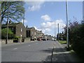
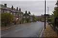
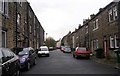
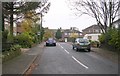
Photos of LS28 5QP
Area Information
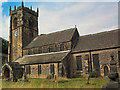
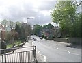
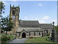
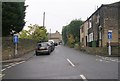
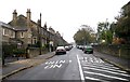
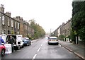
LS28 5QP is a small, tightly knit residential postcode in west Leeds, covering 47.5 hectares and home to 1,699 people. It lies within the Calverley and Farsley ward, a historically significant area with ties to medieval heritage, including Calverley Old Hall, a 14th-century manor house. The area’s population density of 538 people per square kilometre reflects its compact nature, with most residents living in houses rather than apartments. Located approximately 10 miles from Leeds city centre and four miles from Bradford, LS28 5QP sits on the A657 road, offering easy access to both urban and rural settings. The community is predominantly middle-aged, with a median age of 47, and the majority of residents are homeowners. Daily life here balances proximity to city amenities with a quieter, more residential feel, supported by nearby retail hubs, rail links, and two major airports within reach. The area’s low crime risk and minimal flood risk further enhance its appeal for those seeking stability and connectivity.
- Area Type
- Postcode
- Area Size
- 47.5 hectares
- Population
- 1699
- Population Density
- 538 people/km²
LS28 5QP is a predominantly owner-occupied area, with 88% of residents living in homes they own. The housing stock consists entirely of houses, rather than flats or apartments, which is uncommon in many urban postcode areas. This suggests a focus on family homes and long-term residency, with limited rental properties available. The small size of the postcode—just 47.5 hectares—means the housing market is likely tight, with few new developments. For buyers, this creates a competitive environment, particularly for those seeking larger properties. The high proportion of owner-occupied homes also indicates strong community stability, which can be appealing to homebuyers prioritising security and established neighbourhoods. However, the limited availability of rental properties may make LS28 5QP less attractive to those requiring flexibility in housing arrangements.
House Prices in LS28 5QP
Showing 43 properties
| Address | Type | Beds | Baths | Last Sale Price | Last Sale Date | |
|---|---|---|---|---|---|---|
| 66 Clara Drive, Calverley, Pudsey, LS28 5QP | Detached | 4 | 3 | £1,070,000 | Jul 2025 | |
| Marrakech, 58 Clara Drive, Calverley, Pudsey, LS28 5QP | Detached | 3 | 1 | £450,000 | Nov 2021 | |
| Hunters Lodge, 32 Clara Drive, Calverley, Pudsey, LS28 5QP | Bungalow | - | - | £560,000 | Aug 2021 | |
| Champion House Residential Home, Clara Drive, Calverley, Pudsey, LS28 5QP | hospital_care_home | - | - | £1,031,070 | Jul 2019 | |
| Firle House, 25 Clara Drive, Calverley, Pudsey, LS28 5QP | Detached | 5 | - | £850,000 | Feb 2019 | |
| Colvilla, 21 Clara Drive, Calverley, Pudsey, LS28 5QP | Detached | 4 | 3 | £705,000 | Oct 2017 | |
| Langford House, 68 Clara Drive, Calverley, Pudsey, LS28 5QP | Detached | 5 | 3 | £774,000 | Jul 2017 | |
| 5A Clara Drive, Calverley, Pudsey, LS28 5QP | Detached | 3 | 2 | £870,000 | Sep 2016 | |
| 28 Clara Drive, Calverley, Pudsey, LS28 5QP | Detached | 4 | 2 | £550,000 | Sep 2015 | |
| 38 Clara Drive, Calverley, Pudsey, LS28 5QP | Bungalow | 3 | - | £400,000 | Jun 2015 |
Energy Efficiency in LS28 5QP
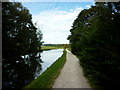
Living in LS28 5QP offers access to a range of essential amenities within easy reach. Retail options include major supermarkets such as Asda Greengates, Sainsburys Bradford, and Farmfoods Eccleshill, ensuring convenient shopping for daily needs. The area’s rail network, with stations like Apperley Bridge and New Pudsey, provides efficient links to Leeds and Bradford, supporting both local and regional travel. Proximity to Leeds Bradford Airport and Leeds Bradford International Airport adds to the area’s appeal for frequent travellers. While the area lacks detailed information on parks or leisure facilities, its location on the A657 road and historical landmarks like Calverley Cutting suggest a blend of practicality and heritage. The combination of retail, transport, and airport access makes LS28 5QP a functional choice for those prioritising convenience and connectivity in their daily lives.
Amenities
Schools
| Rank | School | Type | Entry gender | Ages |
|---|
Explore more schools in this area
Go to Schools tabDemographics
The population of LS28 5QP is 1,699, with a median age of 47 and the majority of residents falling within the 30-64 age range. Home ownership is exceptionally high at 88%, reflecting a community of long-term residents rather than renters. All properties in the area are houses, indicating a preference for family-friendly, standalone homes. The predominant ethnic group is White, aligning with broader trends in the Calverley and Farsley ward, where 80.8% of the population identifies as White. While specific deprivation data for LS28 5QP is not provided, the wider ward is noted for mid-range deprivation levels, suggesting a mix of economic conditions. The age profile and high home ownership suggest a stable, established community, with fewer transient populations. This demographic structure may influence local services and amenities, catering more to settled families and professionals than to younger or more mobile groups.
Household Size
Accommodation Type
Tenure
Ethnic Group
Religion
Household Composition
Age
Household Deprivation
NS-SEC
Explore more demographic insights in this area
Go to Demographics tabPlanning
Planning Constraints
- Flood RiskPremium
- Ramsar Wetland SitesPremium
- Area of Outstanding Natural BeautyPremium
- Protected Nature ReservePremium
- Protected WoodlandPremium