Area Overview for LS28 5JW
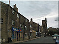
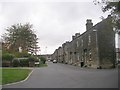
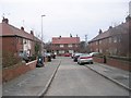
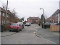
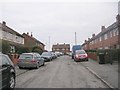
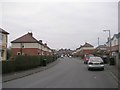
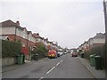
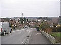
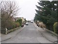
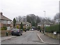
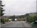
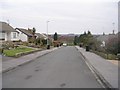
Photos of LS28 5JW
Area Information
LS28 5JW is a small, tightly packed residential postcode in west Leeds, England, covering 3,947 square metres and home to 1,612 people. This area sits within the Calverley and Farsley electoral ward, a historically significant part of Leeds that includes the village of Calverley and the town of Farsley. The region is defined by its compact size and high population density—408,378 people per square kilometre—suggesting a mix of established housing and closely knit communities. The area’s character is shaped by its proximity to the A657 road, which links it to nearby towns like Pudsey and Bradford, just four miles away. Notable historical features include Calverley Old Hall, a 14th-century manor house, and Calverley Cutting, a 19th-century road carved through sandstone. While the area lacks detailed modern economic data, its demographic profile—predominantly White residents, with a median age of 47—hints at a mature, settled population. Living here means being near retail hubs like Co-op Farsley and Asda Pudsey, as well as rail links to major cities. For buyers, this is a compact, well-connected postcode with a mix of historical charm and practical amenities.
- Area Type
- Postcode
- Area Size
- 3947 m²
- Population
- 1612
- Population Density
- 4291 people/km²
The property market in LS28 5JW is characterised by a high rate of home ownership—66%—with houses being the primary accommodation type. This suggests a predominantly owner-occupied area, where long-term residency is common. Given the small size of the postcode and its integration into the larger Calverley and Farsley ward, the housing stock likely consists of traditional family homes rather than newer developments or rental properties. The absence of data on property types beyond “houses” means the market’s exact composition remains unclear, but the focus on owner-occupation implies limited availability of buy-to-let or rental properties. For buyers, this means a potential emphasis on purchasing rather than renting, with properties likely designed for long-term occupancy. The compact nature of the area may also mean that the immediate surroundings offer similar housing profiles, reinforcing a consistent market dynamic. However, without specific data on property prices or availability, the market’s competitiveness or affordability cannot be assessed.
House Prices in LS28 5JW
Showing 4 properties
| Address | Type | Beds | Baths | Last Sale Price | Last Sale Date | |
|---|---|---|---|---|---|---|
| 32 Charles Street, Farsley, Pudsey, LS28 5JW | Terraced | 3 | 1 | £251,235 | Jul 2024 | |
| 26 Charles Street, Farsley, Pudsey, LS28 5JW | Terraced | 2 | 1 | £184,995 | Oct 2020 | |
| 30 Charles Street, Farsley, Pudsey, LS28 5JW | house | - | - | - | - | |
| 28 Charles Street, Farsley, Pudsey, LS28 5JW | house | - | - | - | - |
Energy Efficiency in LS28 5JW
Residents of LS28 5JW have access to a range of nearby amenities that support daily life. Retail options include Co-op Farsley, Asda Pudsey, and Lidl Bramley, providing grocery and general shopping needs within easy reach. The area’s rail network is well-served, with stations such as New Pudsey and Bramley offering regular services to Leeds, Bradford, and other nearby towns. While the data does not specify dining or leisure facilities, the presence of multiple retail and transport hubs suggests a practical, convenience-focused lifestyle. The proximity to Leeds Bradford Airport—listed as both Leeds Bradford Airport and Leeds Bradford International Airport—enhances regional connectivity, though it does not provide direct local leisure options. The area’s compact size means that essential services are close by, reducing the need for long commutes. For residents, this balance of retail, transport, and regional access creates a functional, if modest, lifestyle that prioritises practicality over extensive leisure choices.
Amenities
Schools
| Rank | School | Type | Entry gender | Ages |
|---|
Explore more schools in this area
Go to Schools tabDemographics
The population of LS28 5JW is 1,612, with a median age of 47. The majority of residents are adults aged 30–64, reflecting a mature community. Home ownership is high at 66%, with houses being the predominant accommodation type. The ethnic composition is predominantly White, making up 80.8% of the ward’s population, with Asian residents accounting for 13.8%. While specific deprivation data for LS28 5JW is not provided, the broader Calverley and Farsley ward has 81.9% of its population in the mid-range of deprivation, suggesting a mixed quality of life. This aligns with the ward’s ranking near the bottom of Leeds for deprivation, which may influence access to services or employment opportunities. The age profile indicates a community likely focused on stability, with fewer young families but a strong presence of middle-aged residents. The high home ownership rate suggests long-term residency and a preference for private property over rentals. These factors combined create a demographic profile of established, settled individuals with a clear emphasis on homeownership.
Household Size
Accommodation Type
Tenure
Ethnic Group
Religion
Household Composition
Age
Household Deprivation
NS-SEC
Explore more demographic insights in this area
Go to Demographics tabPlanning
Planning Constraints
- Flood RiskPremium
- Ramsar Wetland SitesPremium
- Area of Outstanding Natural BeautyPremium
- Protected Nature ReservePremium
- Protected WoodlandPremium