Area Overview for LS28 5HL
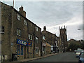
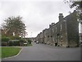
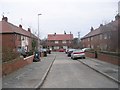
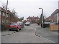
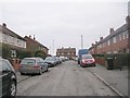
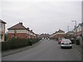
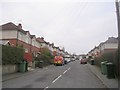
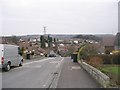
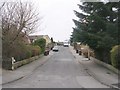
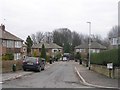
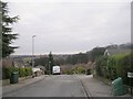
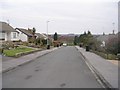
Photos of LS28 5HL
Area Information
LS28 5HL is a small residential postcode area in west Leeds, covering 1.7 hectares and home to 1,543 people. Its high population density of 92,659 people per square kilometre reflects a compact, tightly knit community. Situated near the village of Calverley and the town of Farsley, the area lies on the A657 road, approximately 10 miles from Leeds city centre and four miles from Bradford. Historically, Calverley is marked by Calverley Old Hall, a 14th-century manor house, and Calverley Cutting, a 19th-century road carved through sandstone. The area’s proximity to both urban and rural settings offers a blend of local charm and accessibility. With nearby retail hubs like Co-op Farsley and Asda Pudsey, and rail links to New Pudsey and Bramley stations, residents enjoy practical connectivity. The ward’s population, predominantly White (80.8%) with a median age of 47, suggests a mature, stable community. Living here means navigating a high-density environment with strong local ties, though the small area’s limited size means residents are close to both historical landmarks and modern amenities.
- Area Type
- Postcode
- Area Size
- 1.7 hectares
- Population
- 1543
- Population Density
- 5544 people/km²
The property market in LS28 5HL is characterised by a high rate of home ownership (57%) and a predominance of houses as the primary accommodation type. This suggests a residential area that is largely owner-occupied, with properties likely to be family homes rather than flats or apartments. The small size of the postcode area means that the housing stock is limited, which could lead to competitive conditions for buyers. Given the high population density, properties may be smaller or more compact, reflecting the need to accommodate a large number of residents within a confined space. For buyers, this area offers a mix of traditional housing with historical significance, such as proximity to Calverley Old Hall, and practical modern amenities like nearby retail and transport links. However, the limited size of the area may mean that property choices are restricted to a small number of homes, requiring buyers to consider nearby suburbs or extensions of the ward for more options.
House Prices in LS28 5HL
Showing 32 properties
| Address | Type | Beds | Baths | Last Sale Price | Last Sale Date | |
|---|---|---|---|---|---|---|
| 25 Farfield Avenue, Farsley, Pudsey, LS28 5HL | house | 3 | - | £250,000 | Apr 2023 | |
| 29 Farfield Avenue, Farsley, Pudsey, LS28 5HL | Semi-detached | 2 | - | £128,000 | Oct 2015 | |
| 53 Farfield Avenue, Farsley, Pudsey, LS28 5HL | Semi-detached | 5 | - | £157,000 | Aug 2014 | |
| 50 Farfield Avenue, Farsley, Pudsey, LS28 5HL | house | - | - | £123,000 | May 2013 | |
| 55 Farfield Avenue, Farsley, Pudsey, LS28 5HL | Semi-detached | - | - | £55,000 | Nov 2005 | |
| 21 Farfield Avenue, Farsley, Pudsey, LS28 5HL | Semi-detached | - | - | £42,000 | Jan 1999 | |
| 41 Farfield Avenue, Farsley, Pudsey, LS28 5HL | Semi-detached | - | - | £42,500 | Mar 1998 | |
| 46 Farfield Avenue, Farsley, Pudsey, LS28 5HL | Semi-detached | - | - | £51,500 | Mar 1996 | |
| 49 Farfield Avenue, Farsley, Pudsey, LS28 5HL | Semi-detached | 3 | 1 | - | - | |
| 47 Farfield Avenue, Farsley, Pudsey, LS28 5HL | Semi-detached | 3 | 1 | - | - |
Energy Efficiency in LS28 5HL
Residents of LS28 5HL have access to a range of amenities within practical reach, including retail stores such as Co-op Farsley, Asda Pudsey, and M&S Pudsey. These shopping options provide convenience for daily needs, from groceries to clothing. The area’s rail links to New Pudsey and Bramley stations offer easy access to public transport, enabling residents to travel to nearby towns and cities. Proximity to Leeds Bradford Airport adds to the area’s appeal for those requiring air travel. While the data does not mention parks or leisure facilities, the historical significance of Calverley Old Hall and Calverley Cutting suggests a connection to local heritage. The combination of retail, transport, and historical sites creates a lifestyle that balances practicality with cultural interest, though further details on recreational amenities would be necessary for a complete understanding of daily life in the area.
Amenities
Schools
The nearest school to LS28 5HL is Farsley Farfield Infant School, a primary school serving the local community. While no Ofsted rating is provided, the presence of a primary school indicates that the area supports families with young children. The school’s location within practical reach of residents ensures that parents can access education for their children without long commutes. However, the data does not include information about secondary schools or other educational institutions in the immediate vicinity. This means that families may need to look further afield for secondary education options, potentially impacting the appeal of the area for households with older children. The availability of a primary school is a key factor for families prioritising proximity to schools, though the lack of additional educational facilities may require careful planning for long-term family needs.
| Rank | School | Type | Entry gender | Ages |
|---|
Explore more schools in this area
Go to Schools tabDemographics
The population of LS28 5HL has a median age of 47, with the majority of residents falling into the 30-64 age range. Home ownership is prevalent, with 57% of households owning their properties, while the remaining 43% are likely to be renters. The area is predominantly composed of houses, reflecting a traditional residential character. The predominant ethnic group is White, making up the majority of the population, though specific data on other ethnicities is not provided. The ward, which includes LS28 5HL, has a population of 24,595 and is ranked near the bottom of Leeds for deprivation, with 81.9% of residents in the mid-range of deprivation. This suggests that while the area is not among the most deprived in the city, it may still face challenges related to economic opportunities or access to services. The demographic profile indicates a community that is largely middle-aged, stable, and focused on established housing, with a strong emphasis on local, family-oriented living.
Household Size
Accommodation Type
Tenure
Ethnic Group
Religion
Household Composition
Age
Household Deprivation
NS-SEC
Explore more demographic insights in this area
Go to Demographics tabPlanning
Planning Constraints
- Flood RiskPremium
- Ramsar Wetland SitesPremium
- Area of Outstanding Natural BeautyPremium
- Protected Nature ReservePremium
- Protected WoodlandPremium