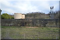
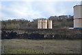
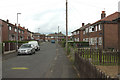
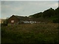
Area Overview for LS27 8EX
Photos of LS27 8EX


Area Information
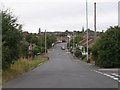
LS27 8EX is a small, densely populated residential cluster in England, covering just 3.2 hectares and home to 2,113 people. Its compact size means residents live close to amenities, with a high population density of 66,632 people per square kilometre. This area is characterised by its mix of established housing and proximity to transport links, making it practical for commuters. The community is predominantly composed of adults aged 30–64, with a median age of 47, suggesting a mature, settled population. While the area lacks large-scale commercial or recreational hubs, its strategic location near rail stations and retail outlets ensures everyday needs are met within short distances. The absence of major environmental constraints, such as protected woodlands or areas of outstanding natural beauty, means development is not restricted, offering potential for future growth. However, the small footprint means housing options are limited, requiring buyers to consider nearby areas for additional choices.
- Area Type
- Postcode
- Area Size
- 3.2 hectares
- Population
- 2113
- Population Density
- 5320 people/km²
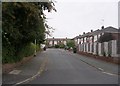
LS27 8EX is a small area where 58% of homes are owner-occupied, with the majority being houses rather than flats or apartments. This suggests a market skewed towards private homeownership, likely attracting families and long-term residents. The limited area size means housing stock is constrained, which could drive competition among buyers. Given the high population density, properties are likely to be smaller or part of terraced housing. For buyers, this area offers proximity to essential services and transport links but may require considering nearby postcode areas for more housing options. The lack of planning constraints, such as protected sites, could make it appealing for those seeking to purchase or renovate. However, the small footprint means buyers should assess whether the area’s size aligns with their long-term needs, particularly for larger families or those requiring more space.
House Prices in LS27 8EX
Showing 1 properties
| Address | Type | Beds | Baths | Last Sale Price | Last Sale Date | |
|---|---|---|---|---|---|---|
| Gasholder Station, Valley Road, Morley, LS27 8EX | Industrial | - | - | - | - |
Energy Efficiency in LS27 8EX
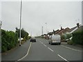
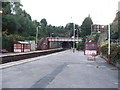
Living in LS27 8EX offers access to essential amenities within practical reach. The area is served by five rail stations, including Morley and Batley, providing connections to nearby towns and cities. Retail options are plentiful, with Sainsburys White, Tesco Morley, and Morrisons Tingley offering a range of groceries and household goods. While the area lacks large parks or leisure facilities, the proximity to rail stations and shops ensures convenience for daily errands and socialising. The compact nature of LS27 8EX means residents can walk or cycle to nearby points of interest, fostering a sense of community. However, the absence of dedicated recreational spaces or dining venues within the postcode suggests that residents may need to travel slightly further for entertainment or leisure activities.
Amenities
Schools
The nearest school to LS27 8EX is Seven Hills Primary School, which holds a 'good' Ofsted rating. This primary school is a key asset for families with young children, offering a reliable educational foundation. The absence of secondary schools or further education institutions in the immediate area means parents may need to consider commuting to nearby towns for secondary education. However, the quality of the primary school suggests a focus on early education, which could be a draw for families prioritising strong foundational schooling. The single school listed indicates a limited range of educational options, but its good rating provides reassurance about the standard of teaching and facilities available to local children.
| Rank | School | Type | Entry gender | Ages |
|---|
Explore more schools in this area
Go to Schools tabDemographics
The population of LS27 8EX is largely composed of adults aged 30–64, with a median age of 47, reflecting a mature demographic. Home ownership is high at 58%, indicating a stable community with long-term residents. The accommodation type is primarily houses, suggesting a mix of family homes and smaller properties. The predominant ethnic group is White, and while no specific deprivation data is provided, the high population density and limited area size may influence living conditions. The compact nature of the area could foster a close-knit community, though the lack of diverse age groups or household types may limit social diversity. With 2,113 residents in 3.2 hectares, the density is exceptionally high, which may impact privacy and space per household. This profile suggests a practical, family-oriented environment with established infrastructure but limited scope for expansion.
Household Size
Accommodation Type
Tenure
Ethnic Group
Religion
Household Composition
Age
Household Deprivation
NS-SEC
Explore more demographic insights in this area
Go to Demographics tabPlanning
Planning Constraints
- Flood RiskPremium
- Ramsar Wetland SitesPremium
- Area of Outstanding Natural BeautyPremium
- Protected Nature ReservePremium
- Protected WoodlandPremium