Area Overview for LS26 9HX
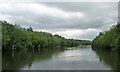
Photos of LS26 9HX
![Birds at St Aidan's [1] in LS26 9HX](https://images.propbar.co.uk/images/geograph/45/80/4580900_120.jpg)
![Drainage outlet from St Aidan's to the River Aire [1] in LS26 9HX](https://images.propbar.co.uk/images/geograph/45/80/4580929_120.jpg)
![Interconnected lakes, St Aidan's [2] in LS26 9HX](https://images.propbar.co.uk/images/geograph/45/80/4580942_120.jpg)
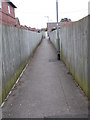
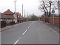
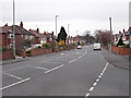
100 photos from this area
Area Information
Key information about the LS26 9HX including its size, population, and administrative classification.
- Area Type
- Postcode
- Area Size
- 2.3 hectares
- Population
- 2202
- Population Density
- 1232 people/km²
House Prices in LS26 9HX
21
Properties
£186,204
Average Sold Price
£57,500
Lowest Price
£341,000
Highest Price
Showing 21 properties
| Address | Type | Beds | Baths | Last Sale Price | Last Sale Date | |
|---|---|---|---|---|---|---|
| 63 Savile Road, Methley, Leeds, LS26 9HX | Semi-detached | 3 | 2 | £325,000 | Mar 2025 | |
| 85 Savile Road, Methley, Leeds, LS26 9HX | Semi-detached | 3 | 1 | £341,000 | Nov 2023 | |
| 89 Savile Road, Methley, Leeds, LS26 9HX | Retail | 4 | 1 | £317,500 | Apr 2022 | |
| 49 Savile Road, Methley, Leeds, LS26 9HX | Semi-detached | 3 | 1 | £200,000 | Nov 2018 | |
| 53 Savile Road, Methley, Leeds, LS26 9HX | Semi-detached | 3 | - | £190,000 | Oct 2018 | |
| 75 Savile Road, Methley, Leeds, LS26 9HX | Semi-detached | 5 | 1 | £267,500 | Jul 2018 | |
| 87 Savile Road, Methley, Leeds, LS26 9HX | Semi-detached | 3 | - | £184,995 | Aug 2014 | |
| 71 Savile Road, Methley, Leeds, LS26 9HX | house | - | - | £155,000 | Apr 2010 | |
| 73 Savile Road, Methley, Leeds, LS26 9HX | Semi-detached | - | - | £57,500 | Nov 1999 | |
| 69 Savile Road, Methley, Leeds, LS26 9HX | Detached | - | - | £67,000 | Sep 1999 |
Page 1 of 3
Energy Efficiency in LS26 9HX
Amenities
Schools
| Rank | School | Type | Entry gender | Ages |
|---|
Explore more schools in this area
Go to Schools tabDemographics
Household Size
Family (3-5 people)
most common
Accommodation Type
Houses
most common
Tenure
80
majority
Ethnic Group
White
most common
Religion
N/A
most common
Household Composition
N/A
most common
Age
47
median
Adults (30-64 years)
most common
Household Deprivation
N/A
with no deprivation
NS-SEC
44
in Lower managerial occupations
Explore more demographic insights in this area
Go to Demographics tabPlanning
Planning Constraints
- Flood RiskPremium
- Ramsar Wetland SitesPremium
- Area of Outstanding Natural BeautyPremium
- Protected Nature ReservePremium
- Protected WoodlandPremium