Area Overview for LS26 9HW
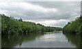
Photos of LS26 9HW
![Birds at St Aidan's [1] in LS26 9HW](https://images.propbar.co.uk/images/geograph/45/80/4580900_120.jpg)
![Drainage outlet from St Aidan's to the River Aire [1] in LS26 9HW](https://images.propbar.co.uk/images/geograph/45/80/4580929_120.jpg)
![Interconnected lakes, St Aidan's [2] in LS26 9HW](https://images.propbar.co.uk/images/geograph/45/80/4580942_120.jpg)
100 photos from this area
Area Information
Key information about the LS26 9HW including its size, population, and administrative classification.
- Area Type
- Postcode
- Area Size
- 7861 m²
- Population
- 2202
- Population Density
- 1232 people/km²
House Prices in LS26 9HW
15
Properties
£199,608
Average Sold Price
£130,250
Lowest Price
£285,000
Highest Price
Showing 15 properties
| Address | Type | Beds | Baths | Last Sale Price | Last Sale Date | |
|---|---|---|---|---|---|---|
| 48 Savile Road, Methley, Leeds, LS26 9HW | Semi-detached | 3 | 1 | £285,000 | Jul 2025 | |
| 70 Savile Road, Methley, Leeds, LS26 9HW | Semi-detached | 3 | 1 | £248,000 | Jun 2023 | |
| 86 Savile Road, Methley, Leeds, LS26 9HW | Semi-detached | 4 | 1 | £255,218 | Sep 2021 | |
| 72 Savile Road, Methley, Leeds, LS26 9HW | Semi-detached | 3 | - | £225,000 | Aug 2017 | |
| 64 Savile Road, Methley, Leeds, LS26 9HW | Semi-detached | 3 | - | £177,000 | Mar 2017 | |
| 52 Savile Road, Methley, Leeds, LS26 9HW | house | 3 | 1 | £130,250 | Oct 2014 | |
| 82 Savile Road, Methley, Leeds, LS26 9HW | Semi-detached | 3 | - | £150,000 | Aug 2013 | |
| 68 Savile Road, Methley, Leeds, LS26 9HW | house | - | - | £171,000 | May 2013 | |
| 80 Savile Road, Methley, Leeds, LS26 9HW | Semi-detached | 3 | 1 | £155,000 | Dec 2010 | |
| 66 Savile Road, Methley, Leeds, LS26 9HW | Semi-detached | - | - | - | - |
Page 1 of 2
Energy Efficiency in LS26 9HW
Amenities
Schools
| Rank | School | Type | Entry gender | Ages |
|---|
Explore more schools in this area
Go to Schools tabDemographics
Household Size
Family (3-5 people)
most common
Accommodation Type
Houses
most common
Tenure
80
majority
Ethnic Group
White
most common
Religion
N/A
most common
Household Composition
N/A
most common
Age
47
median
Adults (30-64 years)
most common
Household Deprivation
N/A
with no deprivation
NS-SEC
44
in Lower managerial occupations
Explore more demographic insights in this area
Go to Demographics tabPlanning
Planning Constraints
- Flood RiskPremium
- Ramsar Wetland SitesPremium
- Area of Outstanding Natural BeautyPremium
- Protected Nature ReservePremium
- Protected WoodlandPremium