Area Overview for LS25 5DA
Photos of LS25 5DA
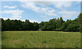
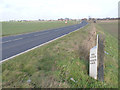
![Field north of Old Quarry Lane [1] in LS25 5DA](https://images.propbar.co.uk/images/geograph/27/36/2736209_120.jpg)
23 photos from this area
Area Information
Key information about the LS25 5DA including its size, population, and administrative classification.
- Area Type
- Postcode
- Area Size
- 16.8 hectares
- Population
- 1717
- Population Density
- 138 people/km²
House Prices in LS25 5DA
13
Properties
£263,750
Average Sold Price
£112,500
Lowest Price
£415,000
Highest Price
Showing 13 properties
| Address | Type | Beds | Baths | Last Sale Price | Last Sale Date | |
|---|---|---|---|---|---|---|
| Kynaston, Lumby Lane, South Milford, LS25 5DA | Detached | - | - | £415,000 | Aug 2006 | |
| Concertina House, Lumby Lane, South Milford, LS25 5DA | Detached | - | - | £112,500 | Jun 1999 | |
| Longheads House, Lumby Lane, South Milford, LS25 5DA | Detached | 4 | 4 | - | - | |
| Tudor Cottage, Lumby Lane, Monk Fryston, LS25 5DA | Detached | - | - | - | - | |
| 6 Lumby Lane, South Milford, LS25 5DA | Terraced | 1 | 1 | - | - | |
| 3 Lumby Lane, South Milford, LS25 5DA | Terraced | 1 | 1 | - | - | |
| 5 Lumby Lane, South Milford, LS25 5DA | Terraced | 1 | 1 | - | - | |
| 9 Lumby Lane, South Milford, LS25 5DA | house | - | - | - | - | |
| 4 Lumby Lane, South Milford, LS25 5DA | house | - | - | - | - | |
| 8 Lumby Lane, South Milford, LS25 5DA | Cottage | 2 | 1 | - | - |
Page 1 of 2
Energy Efficiency in LS25 5DA
Amenities
Schools
| Rank | School | Type | Entry gender | Ages |
|---|
Explore more schools in this area
Go to Schools tabDemographics
Household Size
Two person
most common
Accommodation Type
Houses
most common
Tenure
84
majority
Ethnic Group
White
most common
Religion
N/A
most common
Household Composition
N/A
most common
Age
47
median
Adults (30-64 years)
most common
Household Deprivation
N/A
with no deprivation
NS-SEC
49
in Lower managerial occupations
Explore more demographic insights in this area
Go to Demographics tabPlanning
Planning Constraints
- Flood RiskPremium
- Ramsar Wetland SitesPremium
- Area of Outstanding Natural BeautyPremium
- Protected Nature ReservePremium
- Protected WoodlandPremium