Area Overview for LS25 4AQ
Photos of LS25 4AQ
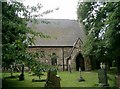
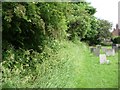
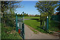
![Churchyard of St Mary the Virgin, Micklefield [1] in LS25 4AQ](https://images.propbar.co.uk/images/geograph/19/10/1910031_120.jpg)
79 photos from this area
Area Information
Key information about the LS25 4AQ including its size, population, and administrative classification.
- Area Type
- Postcode
- Area Size
- 3.9 hectares
- Population
- 1556
- Population Density
- 490 people/km²
House Prices in LS25 4AQ
22
Properties
£185,501
Average Sold Price
£2,000
Lowest Price
£298,812
Highest Price
Showing 22 properties
| Address | Type | Beds | Baths | Last Sale Price | Last Sale Date | |
|---|---|---|---|---|---|---|
| Great Lingadale, Great North Road, Micklefield, Leeds, LS25 4AQ | Detached | 3 | 1 | £271,250 | Nov 2025 | |
| The Old Vicarage, Great North Road, Micklefield, Leeds, LS25 4AQ | Detached | 6 | 3 | £2,000 | Jan 2024 | |
| Autumn House, 205 Great North Road, Micklefield, Leeds, LS25 4AQ | Terraced | 3 | - | £235,000 | Sep 2021 | |
| Forge Garth, Great North Road, Micklefield, Leeds, LS25 4AQ | Bungalow | - | - | £298,812 | Aug 2021 | |
| 207 Great North Road, Micklefield, Leeds, LS25 4AQ | Semi-detached | 3 | 1 | £183,000 | Mar 2018 | |
| The Bungalow, Great North Road, Micklefield, Leeds, LS25 4AQ | Bungalow | 4 | 2 | £235,000 | Sep 2014 | |
| Hill Top Farm, Great North Road, Micklefield, Leeds, LS25 4AQ | Semi-detached | 3 | 1 | £249,999 | Aug 2014 | |
| 203 Great North Road, Micklefield, Leeds, LS25 4AQ | Semi-detached | 3 | 1 | £150,000 | Jul 2006 | |
| 201 Great North Road, Micklefield, Leeds, LS25 4AQ | house | - | - | £169,000 | Dec 2005 | |
| 209 Great North Road, Micklefield, Leeds, LS25 4AQ | Semi-detached | - | - | £164,950 | Sep 2004 |
Page 1 of 3
Energy Efficiency in LS25 4AQ
Amenities
Schools
| Rank | School | Type | Entry gender | Ages |
|---|
Explore more schools in this area
Go to Schools tabDemographics
Household Size
Two person
most common
Accommodation Type
Houses
most common
Tenure
54
majority
Ethnic Group
White
most common
Religion
N/A
most common
Household Composition
N/A
most common
Age
47
median
Adults (30-64 years)
most common
Household Deprivation
N/A
with no deprivation
NS-SEC
30
in Lower managerial occupations
Explore more demographic insights in this area
Go to Demographics tabPlanning
Planning Constraints
- Flood RiskPremium
- Ramsar Wetland SitesPremium
- Area of Outstanding Natural BeautyPremium
- Protected Nature ReservePremium
- Protected WoodlandPremium