Area Overview for LS25 4AP
Photos of LS25 4AP
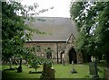
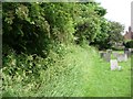
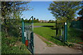
![Churchyard of St Mary the Virgin, Micklefield [1] in LS25 4AP](https://images.propbar.co.uk/images/geograph/19/10/1910031_120.jpg)
79 photos from this area
Area Information
Key information about the LS25 4AP including its size, population, and administrative classification.
- Area Type
- Postcode
- Area Size
- 2.3 hectares
- Population
- 1724
- Population Density
- 86 people/km²
House Prices in LS25 4AP
44
Properties
£139,136
Average Sold Price
£34,000
Lowest Price
£230,000
Highest Price
Showing 44 properties
| Address | Type | Beds | Baths | Last Sale Price | Last Sale Date | |
|---|---|---|---|---|---|---|
| 33 Churchville, Micklefield, Leeds, LS25 4AP | Semi-detached | 3 | 1 | £230,000 | Sep 2024 | |
| 19 Churchville, Micklefield, Leeds, LS25 4AP | Semi-detached | 3 | 1 | £200,000 | Nov 2023 | |
| 27 Churchville, Micklefield, Leeds, LS25 4AP | Semi-detached | 3 | 1 | £190,000 | Sep 2021 | |
| 11 Churchville, Micklefield, Leeds, LS25 4AP | Semi-detached | 3 | 1 | £190,000 | May 2021 | |
| 25 Churchville, Micklefield, Leeds, LS25 4AP | Semi-detached | 3 | - | £140,000 | Jul 2015 | |
| 11A Churchville, Micklefield, Leeds, LS25 4AP | house | - | - | £113,000 | Mar 2013 | |
| 56 Churchville, Micklefield, Leeds, LS25 4AP | house | - | - | £108,000 | Sep 2011 | |
| 18 Churchville, Micklefield, Leeds, LS25 4AP | house | - | - | £93,000 | May 2009 | |
| 17 Churchville, Micklefield, Leeds, LS25 4AP | Semi-detached | - | - | £147,500 | Mar 2008 | |
| 39 Churchville, Micklefield, Leeds, LS25 4AP | Semi-detached | - | - | £85,000 | Feb 2007 |
Page 1 of 5
Energy Efficiency in LS25 4AP
Amenities
Schools
| Rank | School | Type | Entry gender | Ages |
|---|
Explore more schools in this area
Go to Schools tabDemographics
Household Size
Two person
most common
Accommodation Type
Houses
most common
Tenure
80
majority
Ethnic Group
White
most common
Religion
N/A
most common
Household Composition
N/A
most common
Age
47
median
Adults (30-64 years)
most common
Household Deprivation
N/A
with no deprivation
NS-SEC
47
in Lower managerial occupations
Explore more demographic insights in this area
Go to Demographics tabPlanning
Planning Constraints
- Flood RiskPremium
- Ramsar Wetland SitesPremium
- Area of Outstanding Natural BeautyPremium
- Protected Nature ReservePremium
- Protected WoodlandPremium