Area Overview for LS24 9SG
Photos of LS24 9SG
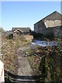
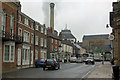

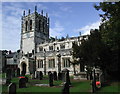
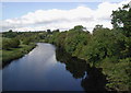
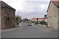
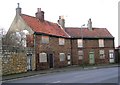
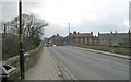
100 photos from this area
Area Information
Key information about the LS24 9SG including its size, population, and administrative classification.
- Area Type
- Postcode
- Area Size
- 3.7 hectares
- Population
- 1156
- Population Density
- 1171 people/km²
House Prices in LS24 9SG
17
Properties
-
Average Sold Price
-
Lowest Price
-
Highest Price
Showing 17 properties
| Address | Type | Beds | Baths | Last Sale Price | Last Sale Date | |
|---|---|---|---|---|---|---|
| The Flat Roof Co, 7C, Guardian Park, Station Road, Tadcaster, LS24 9SG | Industrial | - | - | - | - | |
| Blucher Uk, Unit 6B, Station Estate, Station Road, Tadcaster, LS24 9SG | Industrial | - | - | - | - | |
| Lambert Engineering Ltd, 12-14 Station Estate, Station Road, Tadcaster, LS24 9SG | Industrial | - | - | - | - | |
| Unit 2, Station Estate, Station Road, Tadcaster, LS24 9SG | Industrial | - | - | - | - | |
| Bbs Accounts And Bookkeeping Ltd, Wilton House Annex, Station Road, Tadcaster, LS24 9SG | office_workshop | - | - | - | - | |
| Eddys Moto Ltd, Unit 1 Guardian Park, Station Estate, Station Road, Tadcaster, LS24 9SG | general_industrial | - | - | - | - | |
| Ats Euromaster, Station Estate, Station Road, Tadcaster, LS24 9SG | office_workshop | - | - | - | - | |
| Guardian Park Unit 7A, Station Estate, Station Road, Tadcaster, LS24 9SG | Industrial | - | - | - | - | |
| Guardian Park Unit 6B, Station Estate, Station Road, Tadcaster, LS24 9SG | general_industrial | - | - | - | - | |
| Commercial Services (tadcaster) Ltd, Units 3 To 5, Station Estate, Station Road, Tadcaster, LS24 9SG | Industrial | - | - | - | - |
Page 1 of 2
Energy Efficiency in LS24 9SG
Amenities
Schools
| Rank | School | Type | Entry gender | Ages |
|---|
Explore more schools in this area
Go to Schools tabDemographics
Household Size
One person
most common
Accommodation Type
Houses
most common
Tenure
67
majority
Ethnic Group
White
most common
Religion
N/A
most common
Household Composition
N/A
most common
Age
47
median
Adults (30-64 years)
most common
Household Deprivation
N/A
with no deprivation
NS-SEC
36
in Lower managerial occupations
Explore more demographic insights in this area
Go to Demographics tabPlanning
Planning Constraints
- Flood RiskPremium
- Ramsar Wetland SitesPremium
- Area of Outstanding Natural BeautyPremium
- Protected Nature ReservePremium
- Protected WoodlandPremium