Area Overview for LS22 6SN
Photos of LS22 6SN
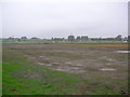
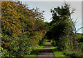
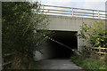
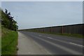

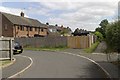

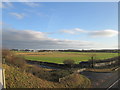

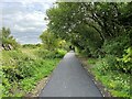
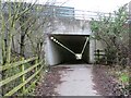
35 photos from this area
Area Information
Key information about the LS22 6SN including its size, population, and administrative classification.
- Area Type
- Postcode
- Area Size
- 3.0 hectares
- Population
- 1369
- Population Density
- 3597 people/km²
House Prices in LS22 6SN
53
Properties
£257,175
Average Sold Price
£79,000
Lowest Price
£476,000
Highest Price
Showing 53 properties
| Address | Type | Beds | Baths | Last Sale Price | Last Sale Date | |
|---|---|---|---|---|---|---|
| 38 Hall Orchards Avenue, Wetherby, LS22 6SN | Detached | 3 | 1 | £400,000 | Aug 2025 | |
| 20 Hall Orchards Avenue, Wetherby, LS22 6SN | Detached | 4 | 2 | £476,000 | Mar 2025 | |
| 35 Hall Orchards Avenue, Wetherby, LS22 6SN | Semi-detached | 3 | 1 | £290,000 | Aug 2024 | |
| 50 Hall Orchards Avenue, Wetherby, LS22 6SN | Detached | 4 | 1 | £356,250 | Aug 2024 | |
| 10 Hall Orchards Avenue, Wetherby, LS22 6SN | house | 4 | 1 | £430,000 | Jul 2024 | |
| 31 Hall Orchards Avenue, Wetherby, LS22 6SN | Semi-detached | 3 | 1 | £245,000 | Nov 2023 | |
| 15 Hall Orchards Avenue, Wetherby, LS22 6SN | Semi-detached | 3 | 1 | £310,000 | Aug 2023 | |
| 43 Hall Orchards Avenue, Wetherby, LS22 6SN | Semi-detached | 4 | 2 | £325,000 | Jun 2023 | |
| 54 Hall Orchards Avenue, Wetherby, LS22 6SN | house | - | - | £248,000 | May 2023 | |
| 18 Hall Orchards Avenue, Wetherby, LS22 6SN | house | - | - | £350,000 | Sep 2021 |
Page 1 of 6
Energy Efficiency in LS22 6SN
Amenities
Schools
| Rank | School | Type | Entry gender | Ages |
|---|
Explore more schools in this area
Go to Schools tabDemographics
Household Size
Two person
most common
Accommodation Type
Houses
most common
Tenure
57
majority
Ethnic Group
White
most common
Religion
N/A
most common
Household Composition
N/A
most common
Age
47
median
Adults (30-64 years)
most common
Household Deprivation
N/A
with no deprivation
NS-SEC
24
in Lower managerial occupations
Explore more demographic insights in this area
Go to Demographics tabPlanning
Planning Constraints
- Flood RiskPremium
- Ramsar Wetland SitesPremium
- Area of Outstanding Natural BeautyPremium
- Protected Nature ReservePremium
- Protected WoodlandPremium