Area Overview for LS21 2DF
Photos of LS21 2DF

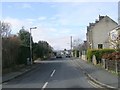
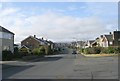
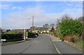
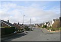

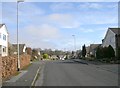
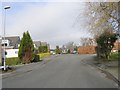
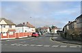
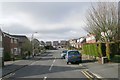
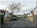
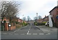
100 photos from this area
Area Information
Key information about the LS21 2DF including its size, population, and administrative classification.
- Area Type
- Postcode
- Area Size
- 8.1 hectares
- Population
- 1613
- Population Density
- 1271 people/km²
House Prices in LS21 2DF
29
Properties
£299,547
Average Sold Price
£14,750
Lowest Price
£550,000
Highest Price
Showing 29 properties
| Address | Type | Beds | Baths | Last Sale Price | Last Sale Date | |
|---|---|---|---|---|---|---|
| 97 Weston Lane, Otley, LS21 2DF | Semi-detached | 4 | 1 | £461,500 | Sep 2023 | |
| 103 Weston Lane, Otley, LS21 2DF | house | - | - | £430,000 | Mar 2021 | |
| 97A Weston Lane, Otley, LS21 2DF | house | - | - | £14,750 | Jun 2020 | |
| 81 Weston Lane, Otley, LS21 2DF | Semi-detached | 3 | 1 | £276,000 | Nov 2019 | |
| 87 Weston Lane, Otley, LS21 2DF | house | - | - | £240,000 | Aug 2019 | |
| 89 Weston Lane, Otley, LS21 2DF | house | - | - | £250,000 | Dec 2018 | |
| 93 Weston Lane, Otley, LS21 2DF | Bungalow | - | - | £175,000 | Jul 2017 | |
| 109 Weston Lane, Otley, LS21 2DF | house | 4 | - | £550,000 | Feb 2017 | |
| 99 Weston Lane, Otley, LS21 2DF | house | - | - | £320,000 | Jan 2014 | |
| 105 Weston Lane, Otley, LS21 2DF | Detached | 4 | - | £415,000 | Jan 2014 |
Page 1 of 3
Energy Efficiency in LS21 2DF
Amenities
Schools
| Rank | School | Type | Entry gender | Ages |
|---|
Explore more schools in this area
Go to Schools tabDemographics
Household Size
One person
most common
Accommodation Type
Houses
most common
Tenure
50
majority
Ethnic Group
White
most common
Religion
N/A
most common
Household Composition
N/A
most common
Age
47
median
Adults (30-64 years)
most common
Household Deprivation
N/A
with no deprivation
NS-SEC
22
in Lower managerial occupations
Explore more demographic insights in this area
Go to Demographics tabPlanning
Planning Constraints
- Flood RiskPremium
- Ramsar Wetland SitesPremium
- Area of Outstanding Natural BeautyPremium
- Protected Nature ReservePremium
- Protected WoodlandPremium