Area Overview for LS17 9AX
Photos of LS17 9AX
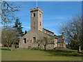
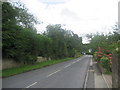
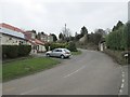
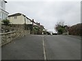
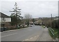
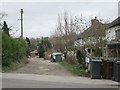
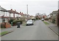
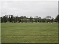
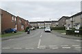
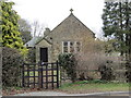
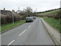
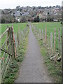
87 photos from this area
Area Information
Key information about the LS17 9AX including its size, population, and administrative classification.
- Area Type
- Postcode
- Area Size
- 4.5 hectares
- Population
- 1785
- Population Density
- 180 people/km²
House Prices in LS17 9AX
25
Properties
£447,209
Average Sold Price
£155,000
Lowest Price
£800,000
Highest Price
Showing 25 properties
| Address | Type | Beds | Baths | Last Sale Price | Last Sale Date | |
|---|---|---|---|---|---|---|
| 7 Grange Close, Bardsey, Leeds, LS17 9AX | Bungalow | - | - | £511,000 | Apr 2023 | |
| 11 Grange Close, Bardsey, Leeds, LS17 9AX | Bungalow | 4 | 3 | £710,000 | Oct 2022 | |
| 6 Grange Close, Bardsey, Leeds, LS17 9AX | house | - | - | £610,000 | Jan 2022 | |
| Linden Acre, Grange Close, Bardsey, Leeds, LS17 9AX | Detached | 6 | - | £800,000 | Jun 2021 | |
| 3 Grange Close, Bardsey, Leeds, LS17 9AX | house | - | - | £682,000 | Jun 2021 | |
| 2 Grange Close, Bardsey, Leeds, LS17 9AX | Detached | 4 | - | £542,500 | Feb 2021 | |
| 20 Grange Close, Bardsey, Leeds, LS17 9AX | Bungalow | 3 | 1 | £545,000 | Dec 2020 | |
| Platform End, 13 Grange Close, Bardsey, Leeds, LS17 9AX | Bungalow | 3 | 1 | £330,013 | Dec 2019 | |
| 10 Grange Close, Bardsey, Leeds, LS17 9AX | Bungalow | - | - | £375,000 | Mar 2019 | |
| 1 Grange Close, Bardsey, Leeds, LS17 9AX | Detached | - | - | £305,000 | Feb 2018 |
Page 1 of 3
Energy Efficiency in LS17 9AX
Amenities
Schools
| Rank | School | Type | Entry gender | Ages |
|---|
Explore more schools in this area
Go to Schools tabDemographics
Household Size
Two person
most common
Accommodation Type
Houses
most common
Tenure
91
majority
Ethnic Group
White
most common
Religion
N/A
most common
Household Composition
N/A
most common
Age
47
median
Adults (30-64 years)
most common
Household Deprivation
N/A
with no deprivation
NS-SEC
53
in Lower managerial occupations
Explore more demographic insights in this area
Go to Demographics tabPlanning
Planning Constraints
- Flood RiskPremium
- Ramsar Wetland SitesPremium
- Area of Outstanding Natural BeautyPremium
- Protected Nature ReservePremium
- Protected WoodlandPremium