Area Overview for LS17 9AN
Photos of LS17 9AN
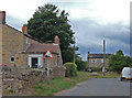

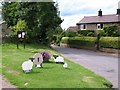
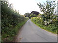
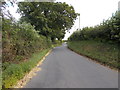
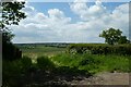
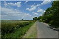
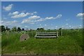
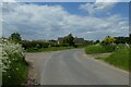
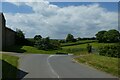
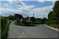
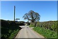
28 photos from this area
Area Information
Key information about the LS17 9AN including its size, population, and administrative classification.
- Area Type
- Postcode
- Area Size
- 1.5 km²
- Population
- 1785
- Population Density
- 180 people/km²
House Prices in LS17 9AN
33
Properties
£498,002
Average Sold Price
£97,000
Lowest Price
£1,400,000
Highest Price
Showing 33 properties
| Address | Type | Beds | Baths | Last Sale Price | Last Sale Date | |
|---|---|---|---|---|---|---|
| Thorn Hedge, Mill Lane, Bardsey, Leeds, LS17 9AN | Semi-detached | 4 | 2 | £550,000 | Jun 2024 | |
| Stone Gap, Mill Lane, Bardsey, Leeds, LS17 9AN | house | - | - | £1,024,950 | Oct 2022 | |
| Stone Rise, Mill Lane, Bardsey, Leeds, LS17 9AN | Bungalow | 3 | - | £570,000 | Apr 2022 | |
| Briar Bank, Mill Lane, Bardsey, Leeds, LS17 9AN | house | - | - | £417,000 | May 2021 | |
| Hampson House, Mill Lane, Bardsey, Leeds, LS17 9AN | Detached | 5 | - | £1,400,000 | Jun 2020 | |
| Sandyway, Mill Lane, Bardsey, Leeds, LS17 9AN | house | 5 | - | £1,185,000 | Mar 2020 | |
| The Gables, Mill Lane, Bardsey, Leeds, LS17 9AN | house | - | - | £630,000 | Jan 2019 | |
| Hillrise, Mill Lane, Bardsey, Leeds, LS17 9AN | Detached | 5 | 5 | £362,000 | Aug 2018 | |
| Highfield, Mill Lane, Bardsey, Leeds, LS17 9AN | house | - | - | £553,000 | Oct 2017 | |
| Burntwood Cottage, Mill Lane, Bardsey, Leeds, LS17 9AN | house | - | - | £725,000 | Feb 2017 |
Page 1 of 4
Energy Efficiency in LS17 9AN
Amenities
Schools
| Rank | School | Type | Entry gender | Ages |
|---|
Explore more schools in this area
Go to Schools tabDemographics
Household Size
Two person
most common
Accommodation Type
Houses
most common
Tenure
91
majority
Ethnic Group
White
most common
Religion
N/A
most common
Household Composition
N/A
most common
Age
47
median
Adults (30-64 years)
most common
Household Deprivation
N/A
with no deprivation
NS-SEC
53
in Lower managerial occupations
Explore more demographic insights in this area
Go to Demographics tabPlanning
Planning Constraints
- Flood RiskPremium
- Ramsar Wetland SitesPremium
- Area of Outstanding Natural BeautyPremium
- Protected Nature ReservePremium
- Protected WoodlandPremium