Area Overview for LS15 8FE
Photos of LS15 8FE
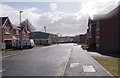

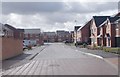
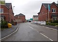
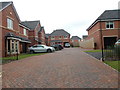
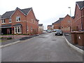

48 photos from this area
Area Information
Key information about the LS15 8FE including its size, population, and administrative classification.
- Area Type
- Postcode
- Area Size
- 1.2 hectares
- Population
- 1816
- Population Density
- 2188 people/km²
House Prices in LS15 8FE
8
Properties
£321,187
Average Sold Price
£66,728
Lowest Price
£419,950
Highest Price
Showing 8 properties
| Address | Type | Beds | Baths | Last Sale Price | Last Sale Date | |
|---|---|---|---|---|---|---|
| 1 Ethel Jackson Road, Manston, Leeds, LS15 8FE | Detached | 4 | 2 | £66,728 | Jan 2025 | |
| 8 Ethel Jackson Road, Manston, Leeds, LS15 8FE | Detached | 4 | 1 | £410,000 | Mar 2021 | |
| 3 Ethel Jackson Road, Manston, Leeds, LS15 8FE | Detached | 4 | 3 | £419,950 | Sep 2017 | |
| 2 Ethel Jackson Road, Manston, Leeds, LS15 8FE | house | - | - | £362,995 | Aug 2013 | |
| 4 Ethel Jackson Road, Manston, Leeds, LS15 8FE | Detached | 4 | 3 | £356,245 | Feb 2013 | |
| 6 Ethel Jackson Road, Manston, Leeds, LS15 8FE | house | - | - | £257,395 | Feb 2013 | |
| 10 Ethel Jackson Road, Manston, Leeds, LS15 8FE | house | - | - | £374,995 | Feb 2013 | |
| Bellway Homes Yorkshire Ltd, Sales Office The Limes At, Ethel Jackson Road, Manston, Leeds, LS15 8FE | commercial | - | - | - | - |
Energy Efficiency in LS15 8FE
Amenities
Schools
| Rank | School | Type | Entry gender | Ages |
|---|
Explore more schools in this area
Go to Schools tabDemographics
Household Size
Two person
most common
Accommodation Type
Houses
most common
Tenure
88
majority
Ethnic Group
White
most common
Religion
N/A
most common
Household Composition
N/A
most common
Age
47
median
Adults (30-64 years)
most common
Household Deprivation
N/A
with no deprivation
NS-SEC
41
in Lower managerial occupations
Explore more demographic insights in this area
Go to Demographics tabPlanning
Planning Constraints
- Flood RiskPremium
- Ramsar Wetland SitesPremium
- Area of Outstanding Natural BeautyPremium
- Protected Nature ReservePremium
- Protected WoodlandPremium