Area Overview for LS13 3LL
Photos of LS13 3LL
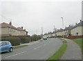
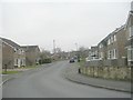
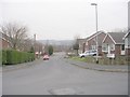
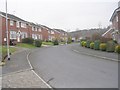
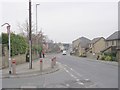
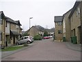
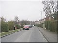
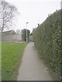
100 photos from this area
Area Information
Key information about the LS13 3LL including its size, population, and administrative classification.
- Area Type
- Postcode
- Area Size
- 4797 m²
- Population
- 1493
- Population Density
- 4426 people/km²
House Prices in LS13 3LL
14
Properties
£155,871
Average Sold Price
£45,000
Lowest Price
£236,000
Highest Price
Showing 14 properties
| Address | Type | Beds | Baths | Last Sale Price | Last Sale Date | |
|---|---|---|---|---|---|---|
| 3 Calverley Terrace, Bramley, Leeds, LS13 3LL | Semi-detached | 3 | 1 | £236,000 | Jul 2025 | |
| 1 Calverley Terrace, Bramley, Leeds, LS13 3LL | Semi-detached | 3 | - | £136,500 | Oct 2024 | |
| 6 Calverley Terrace, Bramley, Leeds, LS13 3LL | Semi-detached | 3 | 1 | £150,000 | Dec 2021 | |
| 12 Calverley Terrace, Bramley, Leeds, LS13 3LL | house | - | - | £215,000 | Sep 2021 | |
| 9 Calverley Terrace, Bramley, Leeds, LS13 3LL | house | - | - | £155,000 | Nov 2020 | |
| 8 Calverley Terrace, Bramley, Leeds, LS13 3LL | Detached | 3 | 1 | £225,000 | Dec 2019 | |
| 11 Calverley Terrace, Bramley, Leeds, LS13 3LL | Semi-detached | 3 | 1 | £142,000 | Nov 2019 | |
| 10 Calverley Terrace, Bramley, Leeds, LS13 3LL | Semi-detached | 3 | 1 | £137,000 | Mar 2019 | |
| 7 Calverley Terrace, Bramley, Leeds, LS13 3LL | Detached | 3 | 1 | £161,000 | Jul 2018 | |
| 4 Calverley Terrace, Bramley, Leeds, LS13 3LL | Semi-detached | 3 | - | £152,950 | Sep 2015 |
Page 1 of 2
Energy Efficiency in LS13 3LL
Amenities
Schools
| Rank | School | Type | Entry gender | Ages |
|---|
Explore more schools in this area
Go to Schools tabDemographics
Household Size
Two person
most common
Accommodation Type
Houses
most common
Tenure
80
majority
Ethnic Group
White
most common
Religion
N/A
most common
Household Composition
N/A
most common
Age
47
median
Adults (30-64 years)
most common
Household Deprivation
N/A
with no deprivation
NS-SEC
35
in Lower managerial occupations
Explore more demographic insights in this area
Go to Demographics tabPlanning
Planning Constraints
- Flood RiskPremium
- Ramsar Wetland SitesPremium
- Area of Outstanding Natural BeautyPremium
- Protected Nature ReservePremium
- Protected WoodlandPremium