Area Overview for LS10 3PG
Photos of LS10 3PG
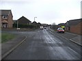
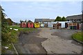

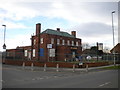
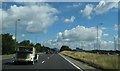
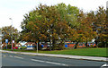

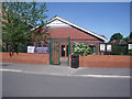
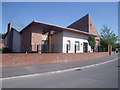

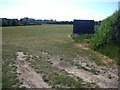

100 photos from this area
Area Information
Key information about the LS10 3PG including its size, population, and administrative classification.
- Area Type
- Postcode
- Area Size
- 1.3 hectares
- Population
- 1537
- Population Density
- 5727 people/km²
House Prices in LS10 3PG
17
Properties
£117,500
Average Sold Price
£85,000
Lowest Price
£145,000
Highest Price
Showing 17 properties
| Address | Type | Beds | Baths | Last Sale Price | Last Sale Date | |
|---|---|---|---|---|---|---|
| 337 Belle Isle Road, Belle Isle, Leeds, LS10 3PG | Semi-detached | 2 | 1 | £135,000 | Jul 2024 | |
| 347 Belle Isle Road, Belle Isle, Leeds, LS10 3PG | house | 2 | - | £125,000 | Mar 2022 | |
| 335 Belle Isle Road, Belle Isle, Leeds, LS10 3PG | house | - | - | £145,000 | Oct 2020 | |
| 345 Belle Isle Road, Belle Isle, Leeds, LS10 3PG | house | - | - | £128,000 | Dec 2018 | |
| 355 Belle Isle Road, Belle Isle, Leeds, LS10 3PG | Semi-detached | 2 | - | £115,000 | Nov 2007 | |
| 341 Belle Isle Road, Belle Isle, Leeds, LS10 3PG | Semi-detached | - | - | £112,000 | Jun 2007 | |
| 361 Belle Isle Road, Belle Isle, Leeds, LS10 3PG | Semi-detached | - | - | £85,000 | Feb 2007 | |
| 363 Belle Isle Road, Belle Isle, Leeds, LS10 3PG | Terraced | - | - | £95,000 | May 2006 | |
| 339 Belle Isle Road, Belle Isle, Leeds, LS10 3PG | Semi-detached | - | - | - | - | |
| 351 Belle Isle Road, Belle Isle, Leeds, LS10 3PG | house | - | - | - | - |
Page 1 of 2
Energy Efficiency in LS10 3PG
Amenities
Schools
| Rank | School | Type | Entry gender | Ages |
|---|
Explore more schools in this area
Go to Schools tabDemographics
Household Size
One person
most common
Accommodation Type
Houses
most common
Tenure
56
majority
Ethnic Group
White
most common
Religion
N/A
most common
Household Composition
N/A
most common
Age
47
median
Adults (30-64 years)
most common
Household Deprivation
N/A
with no deprivation
NS-SEC
16
in Lower managerial occupations
Explore more demographic insights in this area
Go to Demographics tabPlanning
Planning Constraints
- Flood RiskPremium
- Ramsar Wetland SitesPremium
- Area of Outstanding Natural BeautyPremium
- Protected Nature ReservePremium
- Protected WoodlandPremium