Area Overview for LS10 3AA
Photos of LS10 3AA
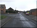
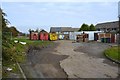


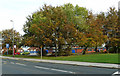


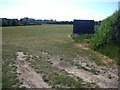

100 photos from this area
Area Information
Key information about the LS10 3AA including its size, population, and administrative classification.
- Area Type
- Postcode
- Area Size
- 1.7 hectares
- Population
- 1537
- Population Density
- 5727 people/km²
House Prices in LS10 3AA
39
Properties
£114,658
Average Sold Price
£49,000
Lowest Price
£185,000
Highest Price
Showing 39 properties
| Address | Type | Beds | Baths | Last Sale Price | Last Sale Date | |
|---|---|---|---|---|---|---|
| 135 Ring Road Middleton, Middleton, Leeds, LS10 3AA | house | - | - | £180,000 | Dec 2022 | |
| 111 Ring Road Middleton, Middleton, Leeds, LS10 3AA | house | - | - | £156,000 | Nov 2021 | |
| 139 Ring Road Middleton, Middleton, Leeds, LS10 3AA | house | - | - | £185,000 | Jun 2021 | |
| 141 Ring Road Middleton, Middleton, Leeds, LS10 3AA | house | - | - | £68,000 | Oct 2013 | |
| 169 Ring Road Middleton, Middleton, Leeds, LS10 3AA | Terraced | 2 | 1 | £49,950 | Jan 2003 | |
| 131 Ring Road Middleton, Middleton, Leeds, LS10 3AA | Semi-detached | - | - | £49,000 | Nov 2002 | |
| 125 Ring Road Middleton, Middleton, Leeds, LS10 3AA | Semi-detached | 2 | 1 | - | - | |
| 121 Ring Road Middleton, Middleton, Leeds, LS10 3AA | Semi-detached | 4 | 1 | - | - | |
| 183 Ring Road Middleton, Middleton, Leeds, LS10 3AA | house | - | - | - | - | |
| 115 Ring Road Middleton, Middleton, Leeds, LS10 3AA | Semi-detached | - | - | - | - |
Page 1 of 4
Energy Efficiency in LS10 3AA
Amenities
Schools
| Rank | School | Type | Entry gender | Ages |
|---|
Explore more schools in this area
Go to Schools tabDemographics
Household Size
One person
most common
Accommodation Type
Houses
most common
Tenure
56
majority
Ethnic Group
White
most common
Religion
N/A
most common
Household Composition
N/A
most common
Age
47
median
Adults (30-64 years)
most common
Household Deprivation
N/A
with no deprivation
NS-SEC
16
in Lower managerial occupations
Explore more demographic insights in this area
Go to Demographics tabPlanning
Planning Constraints
- Flood RiskPremium
- Ramsar Wetland SitesPremium
- Area of Outstanding Natural BeautyPremium
- Protected Nature ReservePremium
- Protected WoodlandPremium