Area Overview for LA10 5PX
Photos of LA10 5PX
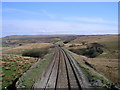
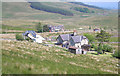
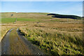
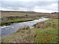
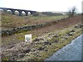
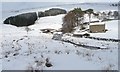
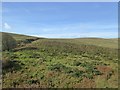
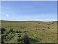
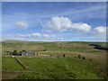
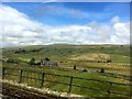
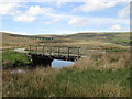
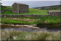
61 photos from this area
Area Information
Key information about the LA10 5PX including its size, population, and administrative classification.
- Area Type
- Postcode
- Area Size
- 3.6 km²
- Population
- 1220
- Population Density
- 9 people/km²
House Prices in LA10 5PX
17
Properties
£565,000
Average Sold Price
£5,000
Lowest Price
£2,100,000
Highest Price
Showing 17 properties
| Address | Type | Beds | Baths | Last Sale Price | Last Sale Date | |
|---|---|---|---|---|---|---|
| Yore House, Moorcock Inn To Aisgill Moor Cottages Road, Lunds, LA10 5PX | house | - | - | £2,100,000 | Apr 2024 | |
| Quarry Cottage, Moorcock Inn To Aisgill Moor Cottages Road, Lunds, LA10 5PX | Detached | - | - | £5,000 | Jan 2018 | |
| Blades House, Moorcock Inn To Aisgill Moor Cottages Road, Lunds, LA10 5PX | Terraced | 3 | 2 | £190,000 | Jul 2017 | |
| The Old School, Moorcock Inn To Aisgill Moor Cottages Road, Lunds, LA10 5PX | Terraced | - | - | £155,000 | May 2013 | |
| South Lunds, Moorcock Inn To Aisgill Moor Cottages Road, Lunds, LA10 5PX | house | 3 | - | £375,000 | Aug 2011 | |
| 1, Grisedale Crossing, Moorcock Inn To Aisgill Moor Cottages Road, Lunds, LA10 5PX | Semi-detached | 3 | 1 | - | - | |
| 2, Grisedale Crossing, Moorcock Inn To Aisgill Moor Cottages Road, Lunds, LA10 5PX | Semi-detached | - | - | - | - | |
| Quarry Farm, Moorcock Inn To Aisgill Moor Cottages Road, Lunds, LA10 5PX | Detached | - | - | - | - | |
| Blades Farm, Moorcock Inn To Aisgill Moor Cottages Road, Lunds, LA10 5PX | Detached | - | - | - | - | |
| Blades Farm Supply, Moorcock Inn To Aisgill Moor Cottages Road, Lunds, LA10 5PX | Industrial | - | - | - | - |
Page 1 of 2
Energy Efficiency in LA10 5PX
Amenities
Schools
| Rank | School | Type | Entry gender | Ages |
|---|
Explore more schools in this area
Go to Schools tabDemographics
Household Size
Two person
most common
Accommodation Type
Houses
most common
Tenure
75
majority
Ethnic Group
White
most common
Religion
N/A
most common
Household Composition
N/A
most common
Age
47
median
Adults (30-64 years)
most common
Household Deprivation
N/A
with no deprivation
NS-SEC
26
in Lower managerial occupations
Explore more demographic insights in this area
Go to Demographics tabPlanning
Planning Constraints
- Flood RiskPremium
- Ramsar Wetland SitesPremium
- Area of Outstanding Natural BeautyPremium
- Protected Nature ReservePremium
- Protected WoodlandPremium