Area Overview for HX5 9BW
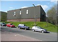
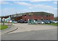
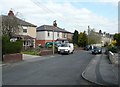
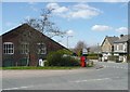
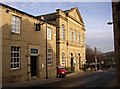
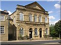
Photos of HX5 9BW


Area Information
HX5 9BW is a small, tightly packed residential postcode in England, covering just 1814 square metres and home to 1821 people. This compact area is characterised by a high population density of over 1 million people per square kilometre, reflecting its role as a densely populated residential cluster. Daily life here is shaped by proximity to essential services and transport links. The area’s small size means residents are likely to know their neighbours, though the high density may influence community dynamics. With a median age of 47 and a population skewed toward adults aged 30–64, the area is likely to have a mature, stable community. Living in HX5 9BW offers access to nearby rail networks and retail hubs, making it practical for commuters and shoppers. However, the small footprint means the area is best suited for those prioritising convenience over expansive living spaces.
- Area Type
- Postcode
- Area Size
- 1814 m²
- Population
- 1821
- Population Density
- 2237 people/km²
The property market in HX5 9BW is defined by a 50% home ownership rate, suggesting a balance between owner-occupied and rental properties. The area is primarily composed of houses, which may indicate a focus on family homes or traditional housing stock. Given the small size of the postcode, the housing stock is likely limited, with little scope for expansion. This could create a competitive market for buyers, particularly those seeking properties in the immediate vicinity. The predominance of houses may appeal to those prioritising space or privacy, though the high population density suggests proximity to other properties. Buyers should consider the area’s compact nature and the potential for limited availability of new developments.
House Prices in HX5 9BW
Showing 1 properties
| Address | Type | Beds | Baths | Last Sale Price | Last Sale Date | |
|---|---|---|---|---|---|---|
| Cdp Limited, Huddersfield Road, Elland, HX5 9BW | Industrial | - | - | - | - |
Energy Efficiency in HX5 9BW
Living in HX5 9BW offers access to a range of nearby amenities, including retail outlets such as Aldi Lower, Morrisons Lower, and Co-op Greetland, which provide essential shopping options. The area’s proximity to multiple railway stations—Brighouse, Halifax, and Huddersfield—ensures easy access to public transport, facilitating travel to nearby towns and cities. While the data does not specify parks or leisure facilities, the presence of retail and rail links suggests a practical, service-oriented lifestyle. Residents can expect convenience in daily errands and connectivity to broader regional networks, though the area’s small size may limit the availability of specialist amenities or green spaces.
Amenities
Schools
| Rank | School | Type | Entry gender | Ages |
|---|
Explore more schools in this area
Go to Schools tabDemographics
The population of HX5 9BW is predominantly composed of adults aged 30–64, with a median age of 47. This suggests a community of working-age individuals and families, rather than a younger or elderly demographic. Home ownership stands at 50%, indicating a mix of owner-occupied properties and rental homes. The area is characterised by houses as the primary accommodation type, which may reflect a preference for traditional housing over flats or apartments. The predominant ethnic group is White, though no specific data on diversity or deprivation levels is provided. The high population density of over 1 million people per square kilometre implies a compact, possibly urbanised environment, which may influence local services and infrastructure demands.
Household Size
Accommodation Type
Tenure
Ethnic Group
Religion
Household Composition
Age
Household Deprivation
NS-SEC
Explore more demographic insights in this area
Go to Demographics tabPlanning
Planning Constraints
- Flood RiskPremium
- Ramsar Wetland SitesPremium
- Area of Outstanding Natural BeautyPremium
- Protected Nature ReservePremium
- Protected WoodlandPremium