Area Overview for HX5 0EE
Photos of HX5 0EE

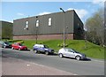
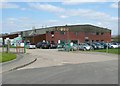
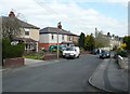

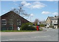
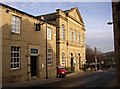

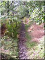
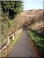
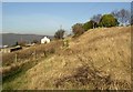
100 photos from this area
Area Information
Key information about the HX5 0EE including its size, population, and administrative classification.
- Area Type
- Postcode
- Area Size
- 4.5 hectares
- Population
- 1821
- Population Density
- 2237 people/km²
House Prices in HX5 0EE
51
Properties
£101,804
Average Sold Price
£23,500
Lowest Price
£220,000
Highest Price
Showing 51 properties
| Address | Type | Beds | Baths | Last Sale Price | Last Sale Date | |
|---|---|---|---|---|---|---|
| 121 Huddersfield Road, Elland, HX5 0EE | house | - | - | £79,000 | Jun 2024 | |
| 167 Huddersfield Road, Elland, HX5 0EE | Terraced | 3 | 1 | £175,000 | Nov 2023 | |
| 181 Huddersfield Road, Elland, HX5 0EE | Semi-detached | 3 | 1 | £157,500 | Aug 2023 | |
| 120 Huddersfield Road, Elland, HX5 0EE | house | - | - | £197,500 | Apr 2023 | |
| 123 Huddersfield Road, Elland, HX5 0EE | house | - | - | £165,000 | Sep 2022 | |
| 165 Huddersfield Road, Elland, HX5 0EE | Terraced | 3 | - | £165,000 | May 2022 | |
| 117 Huddersfield Road, Elland, HX5 0EE | Terraced | 3 | - | £150,000 | Feb 2022 | |
| Former, 114A Huddersfield Road, Elland, HX5 0EE | Detached | 2 | 2 | £90,000 | Oct 2021 | |
| House Rear Of The Ingrams, Huddersfield Road, Elland, HX5 0EE | house | - | - | £220,000 | Oct 2021 | |
| 112 Huddersfield Road, Elland, HX5 0EE | Terraced | 2 | 1 | £100,500 | Dec 2019 |
Page 1 of 6
Energy Efficiency in HX5 0EE
Amenities
Schools
| Rank | School | Type | Entry gender | Ages |
|---|
Explore more schools in this area
Go to Schools tabDemographics
Household Size
One person
most common
Accommodation Type
Houses
most common
Tenure
50
majority
Ethnic Group
White
most common
Religion
N/A
most common
Household Composition
N/A
most common
Age
47
median
Adults (30-64 years)
most common
Household Deprivation
N/A
with no deprivation
NS-SEC
21
in Lower managerial occupations
Explore more demographic insights in this area
Go to Demographics tabPlanning
Planning Constraints
- Flood RiskPremium
- Ramsar Wetland SitesPremium
- Area of Outstanding Natural BeautyPremium
- Protected Nature ReservePremium
- Protected WoodlandPremium