Area Overview for HU8 0EG
Photos of HU8 0EG
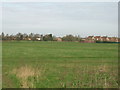
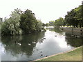


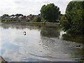
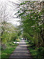
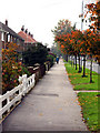
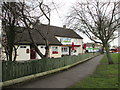


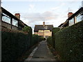
100 photos from this area
Area Information
Key information about the HU8 0EG including its size, population, and administrative classification.
- Area Type
- Postcode
- Area Size
- 1.0 hectares
- Population
- 1488
- Population Density
- 6139 people/km²
House Prices in HU8 0EG
37
Properties
£102,748
Average Sold Price
£43,500
Lowest Price
£202,000
Highest Price
Showing 37 properties
| Address | Type | Beds | Baths | Last Sale Price | Last Sale Date | |
|---|---|---|---|---|---|---|
| 56 Burbage Avenue, Kingston Upon Hull, HU8 0EG | Semi-detached | 3 | 2 | £202,000 | Sep 2023 | |
| 82 Burbage Avenue, Kingston Upon Hull, HU8 0EG | house | 3 | 1 | £175,000 | Mar 2023 | |
| 92 Burbage Avenue, Kingston Upon Hull, HU8 0EG | house | - | - | £165,000 | Oct 2021 | |
| 100 Burbage Avenue, Kingston Upon Hull, HU8 0EG | Semi-detached | 3 | - | £141,000 | Jul 2016 | |
| 102 Burbage Avenue, Kingston Upon Hull, HU8 0EG | Semi-detached | 3 | 1 | £140,000 | Nov 2015 | |
| 62 Burbage Avenue, Kingston Upon Hull, HU8 0EG | Bungalow | 2 | 1 | £105,000 | Mar 2014 | |
| 64 Burbage Avenue, Kingston Upon Hull, HU8 0EG | Bungalow | - | - | £85,000 | Jan 2014 | |
| 61 Burbage Avenue, Kingston Upon Hull, HU8 0EG | Detached | 2 | 1 | £117,000 | Dec 2013 | |
| 90 Burbage Avenue, Kingston Upon Hull, HU8 0EG | Bungalow | 1 | - | £108,000 | Oct 2013 | |
| 66 Burbage Avenue, Kingston Upon Hull, HU8 0EG | house | - | - | £130,000 | Oct 2009 |
Page 1 of 4
Energy Efficiency in HU8 0EG
Amenities
Schools
| Rank | School | Type | Entry gender | Ages |
|---|
Explore more schools in this area
Go to Schools tabDemographics
Household Size
Two person
most common
Accommodation Type
Houses
most common
Tenure
91
majority
Ethnic Group
White
most common
Religion
N/A
most common
Household Composition
N/A
most common
Age
47
median
Adults (30-64 years)
most common
Household Deprivation
N/A
with no deprivation
NS-SEC
29
in Lower managerial occupations
Explore more demographic insights in this area
Go to Demographics tabPlanning
Planning Constraints
- Flood RiskPremium
- Ramsar Wetland SitesPremium
- Area of Outstanding Natural BeautyPremium
- Protected Nature ReservePremium
- Protected WoodlandPremium