Area Overview for HU5 5ND
Photos of HU5 5ND


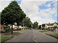
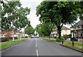
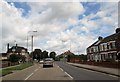


100 photos from this area
Area Information
Key information about the HU5 5ND including its size, population, and administrative classification.
- Area Type
- Postcode
- Area Size
- 9143 m²
- Population
- 1333
- Population Density
- 5524 people/km²
House Prices in HU5 5ND
39
Properties
£94,814
Average Sold Price
£27,500
Lowest Price
£185,000
Highest Price
Showing 39 properties
| Address | Type | Beds | Baths | Last Sale Price | Last Sale Date | |
|---|---|---|---|---|---|---|
| 6 Westlands Road, Kingston Upon Hull, HU5 5ND | Terraced | 2 | 1 | £145,000 | Jan 2025 | |
| 70 Westlands Road, Kingston Upon Hull, HU5 5ND | Terraced | 2 | 1 | £138,000 | Mar 2024 | |
| 68 Westlands Road, Kingston Upon Hull, HU5 5ND | house | - | - | £117,000 | Jul 2023 | |
| 78 Westlands Road, Kingston Upon Hull, HU5 5ND | Terraced | 3 | 1 | £185,000 | Jul 2023 | |
| 66 Westlands Road, Kingston Upon Hull, HU5 5ND | Terraced | 2 | 1 | £118,500 | Jul 2023 | |
| 22 Westlands Road, Kingston Upon Hull, HU5 5ND | Retail | 2 | 1 | £170,000 | Mar 2023 | |
| 26 Westlands Road, Kingston Upon Hull, HU5 5ND | Terraced | 2 | 1 | £132,000 | Oct 2022 | |
| 10 Westlands Road, Kingston Upon Hull, HU5 5ND | Terraced | 2 | 1 | £165,000 | Jul 2022 | |
| 52 Westlands Road, Kingston Upon Hull, HU5 5ND | house | - | - | £145,000 | Mar 2022 | |
| 38 Westlands Road, Kingston Upon Hull, HU5 5ND | Terraced | 3 | 1 | £112,000 | May 2021 |
Page 1 of 4
Energy Efficiency in HU5 5ND
Amenities
Schools
| Rank | School | Type | Entry gender | Ages |
|---|
Explore more schools in this area
Go to Schools tabDemographics
Household Size
Two person
most common
Accommodation Type
Houses
most common
Tenure
66
majority
Ethnic Group
White
most common
Religion
N/A
most common
Household Composition
N/A
most common
Age
47
median
Adults (30-64 years)
most common
Household Deprivation
N/A
with no deprivation
NS-SEC
23
in Lower managerial occupations
Explore more demographic insights in this area
Go to Demographics tabPlanning
Planning Constraints
- Flood RiskPremium
- Ramsar Wetland SitesPremium
- Area of Outstanding Natural BeautyPremium
- Protected Nature ReservePremium
- Protected WoodlandPremium