Area Overview for HU5 2PH
Photos of HU5 2PH
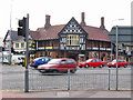


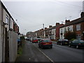
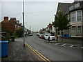
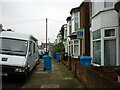
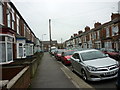
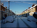

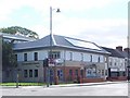
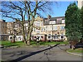
100 photos from this area
Area Information
Key information about the HU5 2PH including its size, population, and administrative classification.
- Area Type
- Postcode
- Area Size
- 6601 m²
- Population
- 1701
- Population Density
- 11074 people/km²
House Prices in HU5 2PH
46
Properties
£68,866
Average Sold Price
£13,000
Lowest Price
£115,000
Highest Price
Showing 46 properties
| Address | Type | Beds | Baths | Last Sale Price | Last Sale Date | |
|---|---|---|---|---|---|---|
| 120 Hardy Street, Kingston Upon Hull, HU5 2PH | house | - | - | £90,000 | Oct 2025 | |
| 89 Hardy Street, Kingston Upon Hull, HU5 2PH | Terraced | 2 | 1 | £78,000 | Aug 2024 | |
| 93 Hardy Street, Kingston Upon Hull, HU5 2PH | Terraced | 2 | 1 | £78,000 | May 2022 | |
| 100 Hardy Street, Kingston Upon Hull, HU5 2PH | house | - | - | £65,000 | Jan 2022 | |
| 113 Hardy Street, Kingston Upon Hull, HU5 2PH | house | - | - | £69,000 | Dec 2020 | |
| 104 Hardy Street, Kingston Upon Hull, HU5 2PH | Terraced | 3 | 1 | £113,000 | Jul 2020 | |
| 114 Hardy Street, Kingston Upon Hull, HU5 2PH | house | - | - | £82,250 | Jan 2020 | |
| 136 Hardy Street, Kingston Upon Hull, HU5 2PH | Terraced | 2 | 2 | £69,000 | Jul 2019 | |
| 112 Hardy Street, Kingston Upon Hull, HU5 2PH | Terraced | 4 | 1 | £110,000 | Apr 2019 | |
| 144 Hardy Street, Kingston Upon Hull, HU5 2PH | Terraced | 3 | 1 | £72,000 | Feb 2019 |
Page 1 of 5
Energy Efficiency in HU5 2PH
Amenities
Schools
| Rank | School | Type | Entry gender | Ages |
|---|
Explore more schools in this area
Go to Schools tabDemographics
Household Size
One person
most common
Accommodation Type
Houses
most common
Tenure
23
majority
Ethnic Group
White
most common
Religion
N/A
most common
Household Composition
N/A
most common
Age
22
median
Young Adults (15-29 years)
most common
Household Deprivation
N/A
with no deprivation
NS-SEC
14
in Lower managerial occupations
Explore more demographic insights in this area
Go to Demographics tabPlanning
Planning Constraints
- Flood RiskPremium
- Ramsar Wetland SitesPremium
- Area of Outstanding Natural BeautyPremium
- Protected Nature ReservePremium
- Protected WoodlandPremium