Area Overview for HU5 1LT
Photos of HU5 1LT


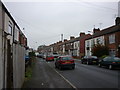
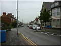
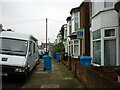
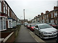


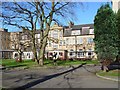
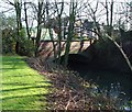
100 photos from this area
Area Information
Key information about the HU5 1LT including its size, population, and administrative classification.
- Area Type
- Postcode
- Area Size
- 1.5 hectares
- Population
- 1701
- Population Density
- 11074 people/km²
House Prices in HU5 1LT
70
Properties
£103,375
Average Sold Price
£50,000
Lowest Price
£210,000
Highest Price
Showing 70 properties
| Address | Type | Beds | Baths | Last Sale Price | Last Sale Date | |
|---|---|---|---|---|---|---|
| 3 Ash Grove, Beverley Road, Kingston Upon Hull, HU5 1LT | Terraced | 1 | 1 | £160,000 | Nov 2024 | |
| 39 Ash Grove, Beverley Road, Kingston Upon Hull, HU5 1LT | house | 5 | 2 | £147,000 | May 2022 | |
| 35 Ash Grove, Beverley Road, Kingston Upon Hull, HU5 1LT | house | - | - | £210,000 | May 2022 | |
| 17-19 Ash Grove, Beverley Road, Kingston Upon Hull, HU5 1LT | Unknown | - | - | £167,500 | Jan 2022 | |
| 87 Ash Grove, Beverley Road, Kingston Upon Hull, HU5 1LT | Terraced | 4 | 1 | £103,000 | Jul 2021 | |
| 5 Ash Grove, Beverley Road, Kingston Upon Hull, HU5 1LT | house | - | - | £210,000 | Apr 2018 | |
| 7 Ash Grove, Beverley Road, Kingston Upon Hull, HU5 1LT | house | - | - | £200,000 | Sep 2017 | |
| 21 Ash Grove, Beverley Road, Kingston Upon Hull, HU5 1LT | Terraced | 6 | - | £185,000 | Nov 2016 | |
| 53 Ash Grove, Beverley Road, Kingston Upon Hull, HU5 1LT | Terraced | 4 | 1 | £78,500 | Mar 2016 | |
| 83 Ash Grove, Beverley Road, Kingston Upon Hull, HU5 1LT | Terraced | 4 | 1 | £86,500 | Mar 2016 |
Page 1 of 7
Energy Efficiency in HU5 1LT
Amenities
Schools
| Rank | School | Type | Entry gender | Ages |
|---|
Explore more schools in this area
Go to Schools tabDemographics
Household Size
One person
most common
Accommodation Type
Houses
most common
Tenure
23
majority
Ethnic Group
White
most common
Religion
N/A
most common
Household Composition
N/A
most common
Age
22
median
Young Adults (15-29 years)
most common
Household Deprivation
N/A
with no deprivation
NS-SEC
14
in Lower managerial occupations
Explore more demographic insights in this area
Go to Demographics tabPlanning
Planning Constraints
- Flood RiskPremium
- Ramsar Wetland SitesPremium
- Area of Outstanding Natural BeautyPremium
- Protected Nature ReservePremium
- Protected WoodlandPremium