Area Overview for HU4 7SW
Photos of HU4 7SW

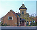
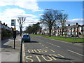

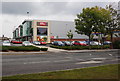
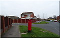
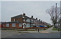
100 photos from this area
Area Information
Key information about the HU4 7SW including its size, population, and administrative classification.
- Area Type
- Postcode
- Area Size
- 1.9 hectares
- Population
- 1337
- Population Density
- 5790 people/km²
House Prices in HU4 7SW
65
Properties
£138,124
Average Sold Price
£33,500
Lowest Price
£265,000
Highest Price
Showing 65 properties
| Address | Type | Beds | Baths | Last Sale Price | Last Sale Date | |
|---|---|---|---|---|---|---|
| 55 Westborough Way, Anlaby Common, HU4 7SW | Detached | 3 | 2 | £235,000 | Nov 2025 | |
| 86 Westborough Way, Anlaby Common, HU4 7SW | Semi-detached | 3 | 1 | £182,500 | Jul 2024 | |
| 60 Westborough Way, Anlaby Common, HU4 7SW | Semi-detached | 3 | 1 | £165,000 | May 2024 | |
| 35 Westborough Way, Anlaby Common, HU4 7SW | Bungalow | 3 | - | £200,000 | May 2024 | |
| 47 Westborough Way, Anlaby Common, HU4 7SW | Terraced | 1 | 1 | £99,950 | Feb 2024 | |
| 77 Westborough Way, Anlaby Common, HU4 7SW | house | - | - | £265,000 | Jan 2023 | |
| 73 Westborough Way, Anlaby Common, HU4 7SW | Detached | 3 | 1 | £185,000 | Dec 2022 | |
| 43 Westborough Way, Anlaby Common, HU4 7SW | Terraced | 1 | 1 | £92,500 | Aug 2022 | |
| 62 Westborough Way, Anlaby Common, HU4 7SW | house | - | - | £215,000 | May 2022 | |
| 101 Westborough Way, Anlaby Common, HU4 7SW | house | 2 | 1 | £141,000 | Mar 2022 |
Page 1 of 7
Energy Efficiency in HU4 7SW
Amenities
Schools
| Rank | School | Type | Entry gender | Ages |
|---|
Explore more schools in this area
Go to Schools tabDemographics
Household Size
Two person
most common
Accommodation Type
Houses
most common
Tenure
88
majority
Ethnic Group
White
most common
Religion
N/A
most common
Household Composition
N/A
most common
Age
47
median
Adults (30-64 years)
most common
Household Deprivation
N/A
with no deprivation
NS-SEC
29
in Lower managerial occupations
Explore more demographic insights in this area
Go to Demographics tabPlanning
Planning Constraints
- Flood RiskPremium
- Ramsar Wetland SitesPremium
- Area of Outstanding Natural BeautyPremium
- Protected Nature ReservePremium
- Protected WoodlandPremium