Area Overview for HU4 7SP
Photos of HU4 7SP

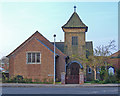
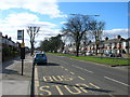

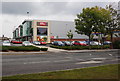
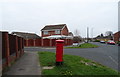
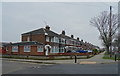
100 photos from this area
Area Information
Key information about the HU4 7SP including its size, population, and administrative classification.
- Area Type
- Postcode
- Area Size
- 9778 m²
- Population
- 1337
- Population Density
- 5790 people/km²
House Prices in HU4 7SP
19
Properties
£141,556
Average Sold Price
£98,000
Lowest Price
£190,000
Highest Price
Showing 19 properties
| Address | Type | Beds | Baths | Last Sale Price | Last Sale Date | |
|---|---|---|---|---|---|---|
| 10 Ashby Close, Anlaby Common, HU4 7SP | Bungalow | 2 | 1 | £190,000 | Jul 2023 | |
| 7 Ashby Close, Anlaby Common, HU4 7SP | Semi-detached | 2 | 1 | £156,500 | Jan 2020 | |
| 3 Ashby Close, Anlaby Common, HU4 7SP | Semi-detached | 3 | 1 | £145,000 | Jun 2018 | |
| 17 Ashby Close, Anlaby Common, HU4 7SP | Semi-detached | 3 | 1 | £145,000 | Feb 2017 | |
| 9 Ashby Close, Anlaby Common, HU4 7SP | Bungalow | 2 | - | £132,000 | Oct 2011 | |
| 12 Ashby Close, Anlaby Common, HU4 7SP | Detached | - | - | £120,000 | Jun 2011 | |
| 6 Ashby Close, Anlaby Common, HU4 7SP | Semi-detached | - | - | £151,500 | Jul 2005 | |
| 15 Ashby Close, Anlaby Common, HU4 7SP | Semi-detached | - | - | £136,000 | Mar 2005 | |
| 1 Ashby Close, Anlaby Common, HU4 7SP | Semi-detached | - | - | £98,000 | Feb 2003 | |
| 4 Ashby Close, Anlaby Common, HU4 7SP | Semi-detached | - | - | - | - |
Page 1 of 2
Energy Efficiency in HU4 7SP
Amenities
Schools
| Rank | School | Type | Entry gender | Ages |
|---|
Explore more schools in this area
Go to Schools tabDemographics
Household Size
Two person
most common
Accommodation Type
Houses
most common
Tenure
88
majority
Ethnic Group
White
most common
Religion
N/A
most common
Household Composition
N/A
most common
Age
47
median
Adults (30-64 years)
most common
Household Deprivation
N/A
with no deprivation
NS-SEC
29
in Lower managerial occupations
Explore more demographic insights in this area
Go to Demographics tabPlanning
Planning Constraints
- Flood RiskPremium
- Ramsar Wetland SitesPremium
- Area of Outstanding Natural BeautyPremium
- Protected Nature ReservePremium
- Protected WoodlandPremium