Area Overview for HU4 6TE
Photos of HU4 6TE
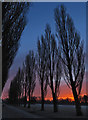
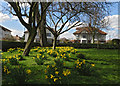
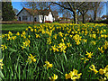
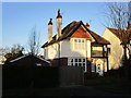
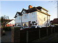
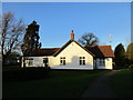
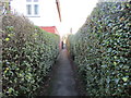
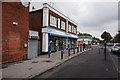
100 photos from this area
Area Information
Key information about the HU4 6TE including its size, population, and administrative classification.
- Area Type
- Postcode
- Area Size
- 3.9 hectares
- Population
- 1556
- Population Density
- 2388 people/km²
House Prices in HU4 6TE
12
Properties
£118,885
Average Sold Price
£43,500
Lowest Price
£230,000
Highest Price
Showing 12 properties
| Address | Type | Beds | Baths | Last Sale Price | Last Sale Date | |
|---|---|---|---|---|---|---|
| 56 Pickering Road, Kingston Upon Hull, HU4 6TE | Terraced | 3 | 1 | £230,000 | Feb 2025 | |
| 68 Pickering Road, Kingston Upon Hull, HU4 6TE | Bungalow | 3 | 1 | £171,312 | Jan 2020 | |
| 72 Pickering Road, Kingston Upon Hull, HU4 6TE | house | - | - | £72,500 | Sep 2013 | |
| 58 Pickering Road, Kingston Upon Hull, HU4 6TE | Terraced | - | - | £113,000 | Apr 2007 | |
| 114 Pickering Road, Kingston Upon Hull, HU4 6TE | Detached | - | - | £83,000 | Nov 1999 | |
| 66 Pickering Road, Kingston Upon Hull, HU4 6TE | Terraced | - | - | £43,500 | Jul 1999 | |
| 60 Pickering Road, Kingston Upon Hull, HU4 6TE | Terraced | - | - | - | - | |
| 70 Pickering Road, Kingston Upon Hull, HU4 6TE | Semi-detached | - | - | - | - | |
| 74 Pickering Road, Kingston Upon Hull, HU4 6TE | Bungalow | - | - | - | - | |
| 76 Pickering Road, Kingston Upon Hull, HU4 6TE | Bungalow | - | - | - | - |
Page 1 of 2
Energy Efficiency in HU4 6TE
Amenities
Schools
| Rank | School | Type | Entry gender | Ages |
|---|
Explore more schools in this area
Go to Schools tabDemographics
Household Size
Two person
most common
Accommodation Type
Houses
most common
Tenure
47
majority
Ethnic Group
White
most common
Religion
N/A
most common
Household Composition
N/A
most common
Age
47
median
Adults (30-64 years)
most common
Household Deprivation
N/A
with no deprivation
NS-SEC
18
in Lower managerial occupations
Explore more demographic insights in this area
Go to Demographics tabPlanning
Planning Constraints
- Flood RiskPremium
- Ramsar Wetland SitesPremium
- Area of Outstanding Natural BeautyPremium
- Protected Nature ReservePremium
- Protected WoodlandPremium