Area Overview for HU4 6EN
Photos of HU4 6EN

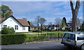
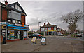
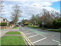


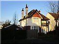


100 photos from this area
Area Information
Key information about the HU4 6EN including its size, population, and administrative classification.
- Area Type
- Postcode
- Area Size
- 1.4 hectares
- Population
- 1513
- Population Density
- 7565 people/km²
House Prices in HU4 6EN
23
Properties
£113,773
Average Sold Price
£30,000
Lowest Price
£230,000
Highest Price
Showing 23 properties
| Address | Type | Beds | Baths | Last Sale Price | Last Sale Date | |
|---|---|---|---|---|---|---|
| 242 Boothferry Road, Kingston Upon Hull, HU4 6EN | Terraced | 3 | 1 | £163,000 | Oct 2025 | |
| 260 Boothferry Road, Kingston Upon Hull, HU4 6EN | Terraced | 3 | 1 | £160,000 | May 2023 | |
| 250 Boothferry Road, Kingston Upon Hull, HU4 6EN | Terraced | 2 | 1 | £87,500 | Sep 2020 | |
| 276-278 Boothferry Road, Kingston Upon Hull, HU4 6EN | Terraced | 3 | 2 | £230,000 | Jul 2020 | |
| 258 Boothferry Road, Kingston Upon Hull, HU4 6EN | Terraced | 3 | 1 | £110,000 | Dec 2018 | |
| 248 Boothferry Road, Kingston Upon Hull, HU4 6EN | Terraced | 2 | 1 | £125,000 | Nov 2018 | |
| 262 Boothferry Road, Kingston Upon Hull, HU4 6EN | Detached | 4 | 2 | £137,500 | Oct 2015 | |
| 264 Boothferry Road, Kingston Upon Hull, HU4 6EN | Terraced | - | - | £112,000 | Feb 2006 | |
| Historic First Floor Flat, 238 Boothferry Road, Kingston Upon Hull, HU4 6EN | Flat | - | - | £60,000 | Nov 2003 | |
| 256 Boothferry Road, Kingston Upon Hull, HU4 6EN | Terraced | - | - | £36,500 | Mar 1999 |
Page 1 of 3
Energy Efficiency in HU4 6EN
Amenities
Schools
| Rank | School | Type | Entry gender | Ages |
|---|
Explore more schools in this area
Go to Schools tabDemographics
Household Size
Two person
most common
Accommodation Type
Houses
most common
Tenure
80
majority
Ethnic Group
White
most common
Religion
N/A
most common
Household Composition
N/A
most common
Age
47
median
Adults (30-64 years)
most common
Household Deprivation
N/A
with no deprivation
NS-SEC
25
in Lower managerial occupations
Explore more demographic insights in this area
Go to Demographics tabPlanning
Planning Constraints
- Flood RiskPremium
- Ramsar Wetland SitesPremium
- Area of Outstanding Natural BeautyPremium
- Protected Nature ReservePremium
- Protected WoodlandPremium