Area Overview for HU4 6DR
Photos of HU4 6DR

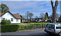
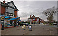
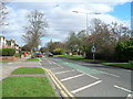

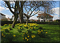

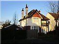
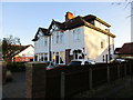
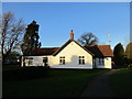
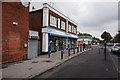
100 photos from this area
Area Information
Key information about the HU4 6DR including its size, population, and administrative classification.
- Area Type
- Postcode
- Area Size
- 1.2 hectares
- Population
- 1513
- Population Density
- 7565 people/km²
House Prices in HU4 6DR
35
Properties
£153,285
Average Sold Price
£53,000
Lowest Price
£240,000
Highest Price
Showing 35 properties
| Address | Type | Beds | Baths | Last Sale Price | Last Sale Date | |
|---|---|---|---|---|---|---|
| 13 Belgrave Drive, Kingston Upon Hull, HU4 6DR | Semi-detached | 3 | 1 | £208,000 | Oct 2025 | |
| 21 Belgrave Drive, Kingston Upon Hull, HU4 6DR | Semi-detached | 3 | 2 | £235,000 | Sep 2025 | |
| 1 Belgrave Drive, Kingston Upon Hull, HU4 6DR | Semi-detached | 3 | 2 | £212,500 | Apr 2025 | |
| 15 Belgrave Drive, Kingston Upon Hull, HU4 6DR | Semi-detached | 3 | 1 | £222,000 | Oct 2023 | |
| 43 Belgrave Drive, Kingston Upon Hull, HU4 6DR | Semi-detached | 3 | 1 | £180,000 | May 2023 | |
| 1A Belgrave Drive, Kingston Upon Hull, HU4 6DR | Semi-detached | 3 | 1 | £198,000 | Mar 2023 | |
| 57 Belgrave Drive, Kingston Upon Hull, HU4 6DR | house | - | - | £240,000 | Aug 2022 | |
| 39 Belgrave Drive, Kingston Upon Hull, HU4 6DR | house | - | - | £205,000 | Oct 2021 | |
| 35 Belgrave Drive, Kingston Upon Hull, HU4 6DR | Semi-detached | 3 | 1 | £170,000 | Jan 2020 | |
| 53 Belgrave Drive, Kingston Upon Hull, HU4 6DR | house | - | - | £182,000 | Dec 2019 |
Page 1 of 4
Energy Efficiency in HU4 6DR
Amenities
Schools
| Rank | School | Type | Entry gender | Ages |
|---|
Explore more schools in this area
Go to Schools tabDemographics
Household Size
Two person
most common
Accommodation Type
Houses
most common
Tenure
80
majority
Ethnic Group
White
most common
Religion
N/A
most common
Household Composition
N/A
most common
Age
47
median
Adults (30-64 years)
most common
Household Deprivation
N/A
with no deprivation
NS-SEC
25
in Lower managerial occupations
Explore more demographic insights in this area
Go to Demographics tabPlanning
Planning Constraints
- Flood RiskPremium
- Ramsar Wetland SitesPremium
- Area of Outstanding Natural BeautyPremium
- Protected Nature ReservePremium
- Protected WoodlandPremium