Area Overview for HU4 6DN
Photos of HU4 6DN

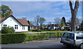
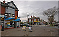
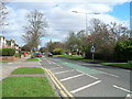

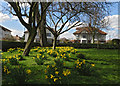

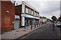
100 photos from this area
Area Information
Key information about the HU4 6DN including its size, population, and administrative classification.
- Area Type
- Postcode
- Area Size
- 1.0 hectares
- Population
- 1513
- Population Density
- 7565 people/km²
House Prices in HU4 6DN
37
Properties
£115,135
Average Sold Price
£47,000
Lowest Price
£206,000
Highest Price
Showing 37 properties
| Address | Type | Beds | Baths | Last Sale Price | Last Sale Date | |
|---|---|---|---|---|---|---|
| 52 Belgrave Drive, Kingston Upon Hull, HU4 6DN | Semi-detached | 3 | 1 | £206,000 | Jun 2023 | |
| 26 Belgrave Drive, Kingston Upon Hull, HU4 6DN | Semi-detached | 3 | 1 | £185,500 | Jun 2023 | |
| 58 Belgrave Drive, Kingston Upon Hull, HU4 6DN | house | - | - | £175,000 | Aug 2022 | |
| 10 Belgrave Drive, Kingston Upon Hull, HU4 6DN | house | - | - | £160,000 | Dec 2021 | |
| 16 Belgrave Drive, Kingston Upon Hull, HU4 6DN | Semi-detached | 3 | 1 | £118,000 | Nov 2019 | |
| 14 Belgrave Drive, Kingston Upon Hull, HU4 6DN | Terraced | 3 | 1 | £130,000 | Jun 2019 | |
| 56 Belgrave Drive, Kingston Upon Hull, HU4 6DN | house | - | - | £143,000 | Jan 2014 | |
| 66 Belgrave Drive, Kingston Upon Hull, HU4 6DN | Semi-detached | - | - | £117,500 | Nov 2012 | |
| 38 Belgrave Drive, Kingston Upon Hull, HU4 6DN | Semi-detached | 3 | - | £115,000 | Nov 2012 | |
| 20 Belgrave Drive, Kingston Upon Hull, HU4 6DN | Flat | 3 | - | £87,500 | Nov 2010 |
Page 1 of 4
Energy Efficiency in HU4 6DN
Amenities
Schools
| Rank | School | Type | Entry gender | Ages |
|---|
Explore more schools in this area
Go to Schools tabDemographics
Household Size
Two person
most common
Accommodation Type
Houses
most common
Tenure
80
majority
Ethnic Group
White
most common
Religion
N/A
most common
Household Composition
N/A
most common
Age
47
median
Adults (30-64 years)
most common
Household Deprivation
N/A
with no deprivation
NS-SEC
25
in Lower managerial occupations
Explore more demographic insights in this area
Go to Demographics tabPlanning
Planning Constraints
- Flood RiskPremium
- Ramsar Wetland SitesPremium
- Area of Outstanding Natural BeautyPremium
- Protected Nature ReservePremium
- Protected WoodlandPremium