Area Overview for HU18 1UL
Photos of HU18 1UL
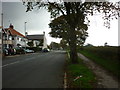
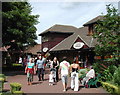
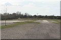
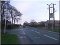
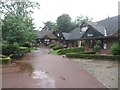
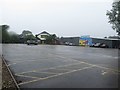
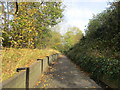
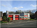
56 photos from this area
Area Information
Key information about the HU18 1UL including its size, population, and administrative classification.
- Area Type
- Postcode
- Area Size
- 1.3 hectares
- Population
- 1664
- Population Density
- 2966 people/km²
House Prices in HU18 1UL
21
Properties
£196,000
Average Sold Price
£31,500
Lowest Price
£465,000
Highest Price
Showing 21 properties
| Address | Type | Beds | Baths | Last Sale Price | Last Sale Date | |
|---|---|---|---|---|---|---|
| Lyndon, Edenfield Avenue, Hornsea, HU18 1UL | Bungalow | 3 | 2 | £310,000 | May 2025 | |
| Edenfield, Edenfield Avenue, Hornsea, HU18 1UL | Bungalow | 2 | 2 | £465,000 | Nov 2023 | |
| The Laurels, Edenfield Avenue, Hornsea, HU18 1UL | Bungalow | - | - | £265,000 | Jan 2022 | |
| Fairview, 6 Edenfield Avenue, Hornsea, HU18 1UL | house | - | - | £130,000 | Sep 2017 | |
| Ballendean, Edenfield Avenue, Hornsea, HU18 1UL | Bungalow | 2 | 1 | £120,000 | May 2012 | |
| Eastlea, Edenfield Avenue, Hornsea, HU18 1UL | Bungalow | 2 | 1 | £50,500 | Mar 1995 | |
| 8 Edenfield Avenue, Hornsea, HU18 1UL | Bungalow | - | - | £31,500 | Jan 1995 | |
| East View, Edenfield Avenue, Hornsea, HU18 1UL | Detached | 3 | 2 | - | - | |
| 1 Edenfield Avenue, Hornsea, HU18 1UL | Retail | 2 | 1 | - | - | |
| 9 Edenfield Avenue, Hornsea, HU18 1UL | Semi-detached | 2 | 1 | - | - |
Page 1 of 3
Energy Efficiency in HU18 1UL
Amenities
Schools
| Rank | School | Type | Entry gender | Ages |
|---|
Explore more schools in this area
Go to Schools tabDemographics
Household Size
Two person
most common
Accommodation Type
Houses
most common
Tenure
61
majority
Ethnic Group
White
most common
Religion
N/A
most common
Household Composition
N/A
most common
Age
47
median
Adults (30-64 years)
most common
Household Deprivation
N/A
with no deprivation
NS-SEC
22
in Lower managerial occupations
Explore more demographic insights in this area
Go to Demographics tabPlanning
Planning Constraints
- Flood RiskPremium
- Ramsar Wetland SitesPremium
- Area of Outstanding Natural BeautyPremium
- Protected Nature ReservePremium
- Protected WoodlandPremium