Area Overview for HU18 1TA
Photos of HU18 1TA
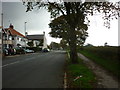
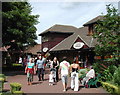
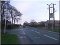
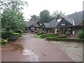
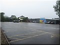
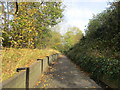
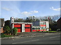
56 photos from this area
Area Information
Key information about the HU18 1TA including its size, population, and administrative classification.
- Area Type
- Postcode
- Area Size
- 1.1 hectares
- Population
- 1664
- Population Density
- 2966 people/km²
House Prices in HU18 1TA
21
Properties
£149,063
Average Sold Price
£52,000
Lowest Price
£300,000
Highest Price
Showing 21 properties
| Address | Type | Beds | Baths | Last Sale Price | Last Sale Date | |
|---|---|---|---|---|---|---|
| 61 Rolston Road, Hornsea, HU18 1TA | Bungalow | - | - | £202,500 | Mar 2022 | |
| 83 Rolston Road, Hornsea, HU18 1TA | Bungalow | - | - | £205,000 | Aug 2021 | |
| 75 Rolston Road, Hornsea, HU18 1TA | Bungalow | - | - | £300,000 | Feb 2021 | |
| 59 Rolston Road, Hornsea, HU18 1TA | Bungalow | - | - | £163,000 | Jun 2020 | |
| 69 Rolston Road, Hornsea, HU18 1TA | Detached | 4 | 2 | £210,000 | Sep 2017 | |
| 79 Rolston Road, Hornsea, HU18 1TA | Bungalow | 3 | 2 | £212,000 | Feb 2017 | |
| 73 Rolston Road, Hornsea, HU18 1TA | house | - | - | £149,950 | Feb 2015 | |
| Uplands, 45 Rolston Road, Hornsea, HU18 1TA | Bungalow | - | - | £97,500 | Mar 2014 | |
| 81 Rolston Road, Hornsea, HU18 1TA | Bungalow | 3 | - | £149,000 | Jun 2013 | |
| 77 Rolston Road, Hornsea, HU18 1TA | house | 4 | - | £136,000 | Nov 2012 |
Page 1 of 3
Energy Efficiency in HU18 1TA
Amenities
Schools
| Rank | School | Type | Entry gender | Ages |
|---|
Explore more schools in this area
Go to Schools tabDemographics
Household Size
Two person
most common
Accommodation Type
Houses
most common
Tenure
61
majority
Ethnic Group
White
most common
Religion
N/A
most common
Household Composition
N/A
most common
Age
47
median
Adults (30-64 years)
most common
Household Deprivation
N/A
with no deprivation
NS-SEC
22
in Lower managerial occupations
Explore more demographic insights in this area
Go to Demographics tabPlanning
Planning Constraints
- Flood RiskPremium
- Ramsar Wetland SitesPremium
- Area of Outstanding Natural BeautyPremium
- Protected Nature ReservePremium
- Protected WoodlandPremium