Area Overview for HU17 8YG
Photos of HU17 8YG
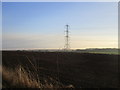
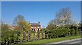
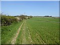
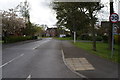
28 photos from this area
Area Information
Key information about the HU17 8YG including its size, population, and administrative classification.
- Area Type
- Postcode
- Area Size
- 2.0 hectares
- Population
- 1458
- Population Density
- 68 people/km²
House Prices in HU17 8YG
20
Properties
£173,808
Average Sold Price
£59,950
Lowest Price
£250,000
Highest Price
Showing 20 properties
| Address | Type | Beds | Baths | Last Sale Price | Last Sale Date | |
|---|---|---|---|---|---|---|
| 8 Huzzard Close, Walkington, HU17 8YG | Terraced | 3 | 2 | £235,000 | Aug 2025 | |
| 5 Huzzard Close, Walkington, HU17 8YG | Retail | 3 | 2 | £230,000 | Oct 2022 | |
| 19 Huzzard Close, Walkington, HU17 8YG | house | - | - | £196,000 | May 2021 | |
| 9 Huzzard Close, Walkington, HU17 8YG | Semi-detached | 3 | 2 | £210,000 | Jun 2020 | |
| 7 Huzzard Close, Walkington, HU17 8YG | Terraced | 3 | 2 | £200,000 | May 2019 | |
| 21 Huzzard Close, Walkington, HU17 8YG | Detached | 3 | 2 | £250,000 | Aug 2017 | |
| 2 Huzzard Close, Walkington, HU17 8YG | Semi-detached | 3 | 2 | £213,000 | Oct 2016 | |
| 4 Huzzard Close, Walkington, HU17 8YG | house | - | - | £165,000 | Dec 2015 | |
| 6 Huzzard Close, Walkington, HU17 8YG | house | - | - | £158,000 | Dec 2013 | |
| 15 Huzzard Close, Walkington, HU17 8YG | house | 3 | - | £207,000 | Aug 2012 |
Page 1 of 2
Energy Efficiency in HU17 8YG
Amenities
Schools
| Rank | School | Type | Entry gender | Ages |
|---|
Explore more schools in this area
Go to Schools tabDemographics
Household Size
Two person
most common
Accommodation Type
Houses
most common
Tenure
84
majority
Ethnic Group
White
most common
Religion
N/A
most common
Household Composition
N/A
most common
Age
47
median
Adults (30-64 years)
most common
Household Deprivation
N/A
with no deprivation
NS-SEC
40
in Lower managerial occupations
Explore more demographic insights in this area
Go to Demographics tabPlanning
Planning Constraints
- Flood RiskPremium
- Ramsar Wetland SitesPremium
- Area of Outstanding Natural BeautyPremium
- Protected Nature ReservePremium
- Protected WoodlandPremium