Area Overview for HU17 8YA
Photos of HU17 8YA
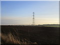
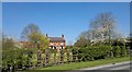
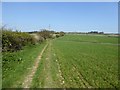
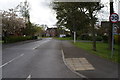
28 photos from this area
Area Information
Key information about the HU17 8YA including its size, population, and administrative classification.
- Area Type
- Postcode
- Area Size
- 13.4 hectares
- Population
- 1955
- Population Density
- 1796 people/km²
House Prices in HU17 8YA
77
Properties
£204,267
Average Sold Price
£72,000
Lowest Price
£465,000
Highest Price
Showing 77 properties
| Address | Type | Beds | Baths | Last Sale Price | Last Sale Date | |
|---|---|---|---|---|---|---|
| 85 Megson Way, Walkington, HU17 8YA | house | 3 | 2 | £275,000 | Jul 2025 | |
| 48 Megson Way, Walkington, HU17 8YA | house | 4 | 2 | £345,000 | May 2025 | |
| 52 Megson Way, Walkington, HU17 8YA | house | 3 | 2 | £337,500 | Apr 2024 | |
| 46 Megson Way, Walkington, HU17 8YA | house | 3 | 2 | £345,000 | May 2023 | |
| 91 Megson Way, Walkington, HU17 8YA | Detached | 3 | 2 | £338,000 | Nov 2022 | |
| 20 Megson Way, Walkington, HU17 8YA | Detached | 4 | 2 | £400,000 | May 2022 | |
| 60 Megson Way, Walkington, HU17 8YA | house | 3 | 2 | £300,000 | Jan 2022 | |
| 99 Megson Way, Walkington, HU17 8YA | house | - | - | £465,000 | Jan 2022 | |
| 30 Megson Way, Walkington, HU17 8YA | Detached | 4 | 2 | £275,000 | Sep 2021 | |
| 62 Megson Way, Walkington, HU17 8YA | house | 4 | - | £365,000 | Jun 2021 |
Page 1 of 8
Energy Efficiency in HU17 8YA
Amenities
Schools
| Rank | School | Type | Entry gender | Ages |
|---|
Explore more schools in this area
Go to Schools tabDemographics
Household Size
Two person
most common
Accommodation Type
Houses
most common
Tenure
86
majority
Ethnic Group
White
most common
Religion
N/A
most common
Household Composition
N/A
most common
Age
47
median
Adults (30-64 years)
most common
Household Deprivation
N/A
with no deprivation
NS-SEC
45
in Lower managerial occupations
Explore more demographic insights in this area
Go to Demographics tabPlanning
Planning Constraints
- Flood RiskPremium
- Ramsar Wetland SitesPremium
- Area of Outstanding Natural BeautyPremium
- Protected Nature ReservePremium
- Protected WoodlandPremium