Area Overview for HU17 7JU
Photos of HU17 7JU
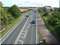
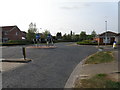
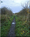

56 photos from this area
Area Information
Key information about the HU17 7JU including its size, population, and administrative classification.
- Area Type
- Postcode
- Area Size
- 1.8 hectares
- Population
- 2295
- Population Density
- 518 people/km²
House Prices in HU17 7JU
15
Properties
£265,286
Average Sold Price
£54,500
Lowest Price
£415,000
Highest Price
Showing 15 properties
| Address | Type | Beds | Baths | Last Sale Price | Last Sale Date | |
|---|---|---|---|---|---|---|
| 181 Woodhall Way, Molescroft, HU17 7JU | house | - | - | £415,000 | May 2022 | |
| 183 Woodhall Way, Molescroft, HU17 7JU | Detached | 4 | 1 | £390,000 | Nov 2020 | |
| 175 Woodhall Way, Molescroft, HU17 7JU | house | - | - | £395,000 | Mar 2020 | |
| 189 Woodhall Way, Molescroft, HU17 7JU | Detached | 4 | 2 | £300,000 | Feb 2013 | |
| 199 Woodhall Way, Molescroft, HU17 7JU | Semi-detached | - | - | £197,500 | Aug 2007 | |
| 179 Woodhall Way, Molescroft, HU17 7JU | Detached | - | - | £105,000 | Nov 1999 | |
| 201 Woodhall Way, Molescroft, HU17 7JU | Detached | 4 | 2 | £54,500 | Aug 1996 | |
| 191 Woodhall Way, Molescroft, HU17 7JU | Detached | - | - | - | - | |
| 197 Woodhall Way, Molescroft, HU17 7JU | Detached | - | - | - | - | |
| 193 Woodhall Way, Molescroft, HU17 7JU | Detached | - | - | - | - |
Page 1 of 2
Energy Efficiency in HU17 7JU
Amenities
Schools
| Rank | School | Type | Entry gender | Ages |
|---|
Explore more schools in this area
Go to Schools tabDemographics
Household Size
Two person
most common
Accommodation Type
Houses
most common
Tenure
85
majority
Ethnic Group
White
most common
Religion
N/A
most common
Household Composition
N/A
most common
Age
47
median
Adults (30-64 years)
most common
Household Deprivation
N/A
with no deprivation
NS-SEC
51
in Lower managerial occupations
Explore more demographic insights in this area
Go to Demographics tabPlanning
Planning Constraints
- Flood RiskPremium
- Ramsar Wetland SitesPremium
- Area of Outstanding Natural BeautyPremium
- Protected Nature ReservePremium
- Protected WoodlandPremium