Area Overview for HU17 7DA
Photos of HU17 7DA
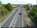
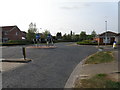

56 photos from this area
Area Information
Key information about the HU17 7DA including its size, population, and administrative classification.
- Area Type
- Postcode
- Area Size
- 2.8 hectares
- Population
- 2295
- Population Density
- 518 people/km²
House Prices in HU17 7DA
30
Properties
£305,456
Average Sold Price
£69,500
Lowest Price
£430,000
Highest Price
Showing 30 properties
| Address | Type | Beds | Baths | Last Sale Price | Last Sale Date | |
|---|---|---|---|---|---|---|
| 120 Woodhall Way, Molescroft, HU17 7DA | house | - | - | £410,000 | Dec 2021 | |
| 128 Woodhall Way, Molescroft, HU17 7DA | house | - | - | £415,000 | Mar 2021 | |
| 154 Woodhall Way, Molescroft, HU17 7DA | Detached | 5 | 3 | £430,000 | Dec 2020 | |
| 162 Woodhall Way, Molescroft, HU17 7DA | Detached | 4 | 2 | £297,000 | Apr 2019 | |
| 156 Woodhall Way, Molescroft, HU17 7DA | Semi-detached | 3 | 2 | £235,000 | Nov 2018 | |
| 144 Woodhall Way, Molescroft, HU17 7DA | Detached | 4 | 2 | £372,000 | Mar 2018 | |
| 150 Woodhall Way, Molescroft, HU17 7DA | Detached | 4 | - | £365,000 | Feb 2017 | |
| 118 Woodhall Way, Molescroft, HU17 7DA | house | - | - | £389,995 | Dec 2015 | |
| 116 Woodhall Way, Molescroft, HU17 7DA | house | - | - | £344,995 | Nov 2015 | |
| 122 Woodhall Way, Molescroft, HU17 7DA | house | - | - | £338,995 | Nov 2015 |
Page 1 of 3
Energy Efficiency in HU17 7DA
Amenities
Schools
| Rank | School | Type | Entry gender | Ages |
|---|
Explore more schools in this area
Go to Schools tabDemographics
Household Size
Two person
most common
Accommodation Type
Houses
most common
Tenure
85
majority
Ethnic Group
White
most common
Religion
N/A
most common
Household Composition
N/A
most common
Age
47
median
Adults (30-64 years)
most common
Household Deprivation
N/A
with no deprivation
NS-SEC
51
in Lower managerial occupations
Explore more demographic insights in this area
Go to Demographics tabPlanning
Planning Constraints
- Flood RiskPremium
- Ramsar Wetland SitesPremium
- Area of Outstanding Natural BeautyPremium
- Protected Nature ReservePremium
- Protected WoodlandPremium