Area Overview for HU16 4RW
Photos of HU16 4RW
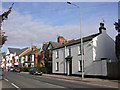
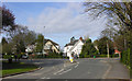
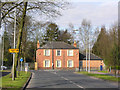
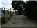
99 photos from this area
Area Information
Key information about the HU16 4RW including its size, population, and administrative classification.
- Area Type
- Postcode
- Area Size
- 2.2 hectares
- Population
- 1168
- Population Density
- 815 people/km²
House Prices in HU16 4RW
45
Properties
£244,067
Average Sold Price
£4,310
Lowest Price
£474,000
Highest Price
Showing 45 properties
| Address | Type | Beds | Baths | Last Sale Price | Last Sale Date | |
|---|---|---|---|---|---|---|
| 40 Cleminson Gardens, Cottingham, HU16 4RW | Detached | 4 | 3 | £470,000 | Oct 2025 | |
| 29 Cleminson Gardens, Cottingham, HU16 4RW | Terraced | 4 | 3 | £223,000 | Sep 2025 | |
| 19 Cleminson Gardens, Cottingham, HU16 4RW | Terraced | 4 | 2 | £227,500 | Jun 2025 | |
| 4 Cleminson Gardens, Cottingham, HU16 4RW | Detached | 5 | 3 | £460,000 | May 2025 | |
| 24 Cleminson Gardens, Cottingham, HU16 4RW | Detached | 4 | 3 | £440,000 | Feb 2024 | |
| 21 Cleminson Gardens, Cottingham, HU16 4RW | Terraced | 4 | 2 | £165,056 | Sep 2022 | |
| 14 Cleminson Gardens, Cottingham, HU16 4RW | Terraced | 3 | 2 | £215,000 | May 2022 | |
| 42 Cleminson Gardens, Cottingham, HU16 4RW | house | - | - | £5,233 | Mar 2022 | |
| 6 Cleminson Gardens, Cottingham, HU16 4RW | Detached | 5 | 1 | £8,010 | Mar 2022 | |
| 12 Cleminson Gardens, Cottingham, HU16 4RW | house | - | - | £192,500 | Dec 2021 |
Page 1 of 5
Energy Efficiency in HU16 4RW
Amenities
Schools
| Rank | School | Type | Entry gender | Ages |
|---|
Explore more schools in this area
Go to Schools tabDemographics
Household Size
Two person
most common
Accommodation Type
Houses
most common
Tenure
85
majority
Ethnic Group
White
most common
Religion
N/A
most common
Household Composition
N/A
most common
Age
47
median
Adults (30-64 years)
most common
Household Deprivation
N/A
with no deprivation
NS-SEC
46
in Lower managerial occupations
Explore more demographic insights in this area
Go to Demographics tabPlanning
Planning Constraints
- Flood RiskPremium
- Ramsar Wetland SitesPremium
- Area of Outstanding Natural BeautyPremium
- Protected Nature ReservePremium
- Protected WoodlandPremium