Area Overview for HU16 4RE
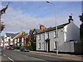
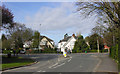
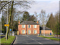
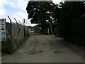
Photos of HU16 4RE
Area Information
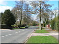
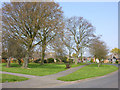
HU16 4RE is a compact residential postcode in England, covering just 2 hectares and home to 1168 residents. Its high population density of 815 people per square kilometre reflects a tightly knit community. This small area is characterised by its mix of established housing and proximity to key transport links, making it practical for commuters. The median age of 47 suggests a stable population of adults in their prime working years, with 85% owning their homes. Daily life here is shaped by local amenities, including five nearby rail stations and a ferry terminal, which connect residents to broader networks. While the area lacks natural conservation designations, its accessibility and modest size make it a convenient base for those prioritising connectivity over rural landscapes. The presence of retail hubs like Heron Cottingham and Co-op Cottingham ensures everyday needs are met within walking distance, reinforcing the area’s practical appeal.
- Area Type
- Postcode
- Area Size
- 2.0 hectares
- Population
- 1168
- Population Density
- 815 people/km²
HU16 4RE is predominantly an owner-occupied area, with 85% of residents living in homes they own. The accommodation type is houses, which suggests a low-density, residential character typical of smaller postcode clusters. This makes the area more attractive to buyers seeking stability and long-term investment rather than rental opportunities. The limited size of the area—just 2 hectares—means the housing stock is constrained, potentially leading to competition among buyers. However, the proximity to rail stations like Cottingham and Hull Railway Station, along with the Hull Ferry Terminal, adds value by improving connectivity. For buyers, this means properties here are likely to be in demand for their practicality, though the small footprint may limit availability. The predominance of owner-occupied homes also suggests a mature market with established property values.
House Prices in HU16 4RE
Showing 1 properties
| Address | Type | Beds | Baths | Last Sale Price | Last Sale Date | |
|---|---|---|---|---|---|---|
| University Of Hull, Conference Centre, Thwaite Hall, Thwaite Street, Cottingham, HU16 4RE | university_college | - | - | - | - |
Energy Efficiency in HU16 4RE
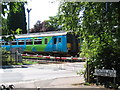
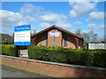
Living in HU16 4RE offers access to a range of practical amenities within easy reach. The area is served by five retail outlets, including Heron Cottingham, Co-op Cottingham, and Aldi Cottingham, ensuring everyday shopping needs are met without long journeys. Rail connectivity is strong, with five stations nearby, including Cottingham and Beverley Railway Stations, facilitating travel to nearby towns and cities. The Hull Ferry Terminal provides an additional link to the east coast, enhancing mobility for residents. While the area lacks expansive parks or leisure facilities, its compact size means amenities are concentrated, reducing the need for lengthy commutes. The presence of multiple retail and transport hubs contributes to a convenient, efficient lifestyle, ideal for those prioritising accessibility over large-scale recreational spaces.
Amenities
Schools
| Rank | School | Type | Entry gender | Ages |
|---|
Explore more schools in this area
Go to Schools tabDemographics
The population of HU16 4RE is predominantly adults aged 30–64, with a median age of 47. This suggests a community of established professionals and families, many of whom own their homes—85% of residents are homeowners. The accommodation type is largely houses, indicating a low-rise, residential character. The predominant ethnic group is White, reflecting the area’s demographic profile. With no data on deprivation, it is reasonable to infer that the community benefits from stability and infrastructure tailored to its age group. The absence of younger or older demographics may mean fewer schools catering to children or retirees, though this is not explicitly stated. The high home ownership rate implies long-term residency and investment in local properties, which can influence property values and community cohesion.
Household Size
Accommodation Type
Tenure
Ethnic Group
Religion
Household Composition
Age
Household Deprivation
NS-SEC
Explore more demographic insights in this area
Go to Demographics tabPlanning
Planning Constraints
- Flood RiskPremium
- Ramsar Wetland SitesPremium
- Area of Outstanding Natural BeautyPremium
- Protected Nature ReservePremium
- Protected WoodlandPremium