Area Overview for HU13 0JB
Photos of HU13 0JB


Area Information
Living in HU13 0JB means inhabiting a tightly knit residential cluster in England, where 1966 people reside across just 3.7 hectares. This compact area has a population density of 1016 people per square kilometre, suggesting a mix of closely spaced homes and shared community spaces. The area’s small size means residents are likely to know their neighbours, with daily life centred around local amenities and nearby transport links. With a median age of 47, the community is predominantly composed of adults aged 30–64, many of whom own their homes. This demographic profile hints at a stable, long-term resident base, with 84% of properties owner-occupied. The area’s proximity to rail stations, retail hubs, and schools makes it practical for families and commuters alike. While the postcode lacks natural constraints like protected woodlands or areas of outstanding beauty, its accessibility to nearby towns and facilities offers a balance between residential tranquillity and urban convenience.
- Area Type
- Postcode
- Area Size
- 3.7 hectares
- Population
- 1966
- Population Density
- 1016 people/km²
The property market in HU13 0JB is characterised by a high rate of home ownership—84% of properties are owner-occupied—suggesting a community of long-term residents rather than transient renters. The area’s accommodation is predominantly houses, which may appeal to those seeking more space or a traditional residential feel. Given the postcode’s small size (3.7 hectares) and population of 1966, the housing stock is limited, meaning buyers should consider the immediate surrounding areas for more options. The focus on owner-occupation implies that properties here are likely to be well-maintained and stable in value. However, the lack of specific data on property prices or recent sales means buyers must rely on local agents for up-to-date market insights. The proximity to rail stations and retail hubs also makes this area attractive for those prioritising convenience over expansive housing.
House Prices in HU13 0JB
Showing 1 properties
| Address | Type | Beds | Baths | Last Sale Price | Last Sale Date | |
|---|---|---|---|---|---|---|
| Strong Life Care, Hesslewood House Care Home, Ferriby Road, Hessle, HU13 0JB | hospital_care_home | - | - | - | - |
Energy Efficiency in HU13 0JB
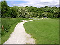
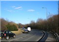
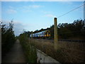
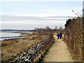
Residents of HU13 0JB have access to a variety of amenities within practical reach. Retail options include Sainsburys Hull, Morrisons Daily, and Heron Hessle, providing essentials for daily living. The five nearby rail stations—Hessle, North Ferriby, and Barton—offer easy access to commuting and regional travel. For leisure, Brough Airport is within the area, though its role is more for regional flights than international travel. While the data does not specify parks or recreational spaces, the absence of protected natural areas suggests that local green spaces may be limited. Nonetheless, the proximity to retail and transport hubs ensures a lifestyle that prioritises convenience. The mix of shops, transport, and nearby schools creates a functional environment for families and commuters, though the area’s small size means residents may need to travel further for broader leisure or cultural activities.
Amenities
Schools
Residents of HU13 0JB have access to a range of schools, including Hessle High School, a primary school, and Hessle High School and Penshurst Primary School, which holds an Ofsted rating of ‘good’. Bridgeview School, a special school, also serves the area, offering tailored education for students with specific needs. This mix of primary and special schools provides families with options depending on their children’s requirements. The presence of a ‘good’-rated primary school may be a key draw for families prioritising educational quality. However, the absence of secondary schools within the postcode means students may need to commute to nearby towns for higher education. The overall school infrastructure suggests a focus on early years and specialist education, which could be a consideration for families with younger children or those requiring additional support.
| Rank | School | Type | Entry gender | Ages |
|---|
Explore more schools in this area
Go to Schools tabDemographics
The community in HU13 0JB is defined by its mature age profile, with a median age of 47 and 84% of residents owning their homes. The most common age range is adults aged 30–64, indicating a population that is largely settled and likely to remain in the area long-term. Accommodation here is predominantly houses, reflecting a residential character that contrasts with high-density housing. The predominant ethnic group is White, which aligns with broader regional trends. With 84% home ownership, the area is not a rental hotspot but rather a place where residents have invested in property. This suggests a stable, low-turnover community. The population density of 1016 people per square kilometre implies a mix of family homes and smaller properties, but the lack of specific data on deprivation or income levels means the quality of life remains unquantified.
Household Size
Accommodation Type
Tenure
Ethnic Group
Religion
Household Composition
Age
Household Deprivation
NS-SEC
Explore more demographic insights in this area
Go to Demographics tabPlanning
Planning Constraints
- Flood RiskPremium
- Ramsar Wetland SitesPremium
- Area of Outstanding Natural BeautyPremium
- Protected Nature ReservePremium
- Protected WoodlandPremium