Area Overview for HU13 0JA
Photos of HU13 0JA
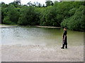
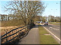
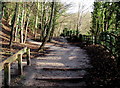
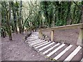
52 photos from this area
Area Information
Key information about the HU13 0JA including its size, population, and administrative classification.
- Area Type
- Postcode
- Area Size
- 10.2 hectares
- Population
- 1837
- Population Density
- 345 people/km²
House Prices in HU13 0JA
7
Properties
-
Average Sold Price
-
Lowest Price
-
Highest Price
Showing 7 properties
| Address | Type | Beds | Baths | Last Sale Price | Last Sale Date | |
|---|---|---|---|---|---|---|
| 2, Hesslewood Cottages, Ferriby Road, Hessle, HU13 0JA | Detached | - | - | - | - | |
| 1, Humber View, Hesslewood Cottages, Ferriby Road, Hessle, HU13 0JA | Semi-detached | - | - | - | - | |
| Managers Flat, Premier Inn Hull West Hotel, Ferriby Road, Hessle, HU13 0JA | Flat | - | - | - | - | |
| Assistant Managers Flat, Premier Inn Hull West Hotel, Ferriby Road, Hessle, HU13 0JA | Flat | - | - | - | - | |
| Blink Agency Limited, The Gazebo, Hesslewood Office Park, Ferriby Road, Hessle, HU13 0JA | office_workshop | - | - | - | - | |
| Premier Inn Hull West Hotel, Ferriby Road, Hessle, HU13 0JA | Flat | - | - | - | - | |
| Quarry House, Hesslewood Office Park, Ferriby Road, Hessle, HU13 0JA | office_workshop | - | - | - | - |
Energy Efficiency in HU13 0JA
Amenities
Schools
| Rank | School | Type | Entry gender | Ages |
|---|
Explore more schools in this area
Go to Schools tabDemographics
Household Size
Two person
most common
Accommodation Type
Houses
most common
Tenure
92
majority
Ethnic Group
White
most common
Religion
N/A
most common
Household Composition
N/A
most common
Age
47
median
Adults (30-64 years)
most common
Household Deprivation
N/A
with no deprivation
NS-SEC
51
in Lower managerial occupations
Explore more demographic insights in this area
Go to Demographics tabPlanning
Planning Constraints
- Flood RiskPremium
- Ramsar Wetland SitesPremium
- Area of Outstanding Natural BeautyPremium
- Protected Nature ReservePremium
- Protected WoodlandPremium